
Last Updated on February 22, 2024 by Grant
Pictured Rocks National Lakeshore stretches more than 40 miles across the northern shoreline of Michigan’s upper peninsula. Established in 1966 as the first national lakeshore in the country, Pictured Rocks protects not just the namesake colorful sandstone cliffs, but beaches and sand dunes as well. In addition to viewing the scenic shoreline, there are many things to do in Pictured Rocks NL.
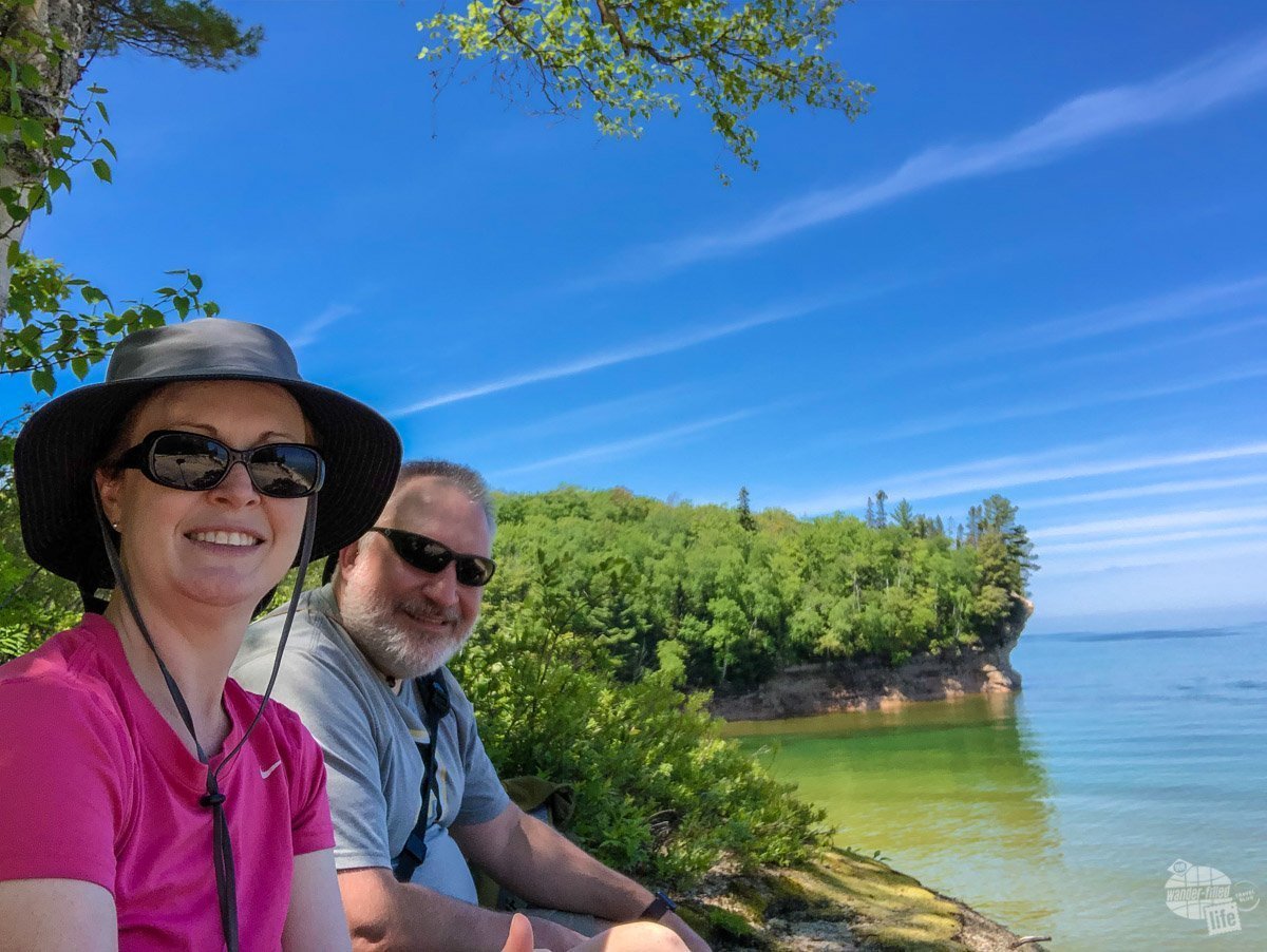
We visited Pictured Rocks as part of our 2019 Great Lakes summer road trip, spending several days camping and exploring the area. From the scenic cruise to the hiking trails, we enjoyed our visit and the natural beauty found here. The fabulous weather and lack of traffic didn’t hurt either.
If you’re planning a trip to Pictured Rocks NL, we’ve got all the information you need to get those plans going.
(Disclaimer: When we link to places where you can buy our stuff or places we stayed, we are using special codes that earn us commissions on the sales at no additional cost to you. Please see our Review Policy for more information.)
Things to Do in Pictured Rocks National Lakeshore
As always, we suggest starting at the visitor center. Pictured Rock NL’s main visitor center is found near the town of Munising, MI. Honestly, this is one of the smallest NPS visitor centers we’ve ever seen but it is still a good place to pick up a map and get some information. In fact, the ranger we spoke to did a fabulous job pointing out the highlights and preparing us for our visit.
The visitor center did not have many displays or even a movie. Still, we left the visitor center with a long list of things to do in Pictured Rocks NL, including viewing waterfalls, stopping at scenic overlooks, hiking, visiting a lighthouse and playing in the sand on the beach or at the sand dunes.
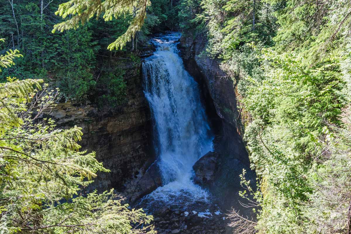
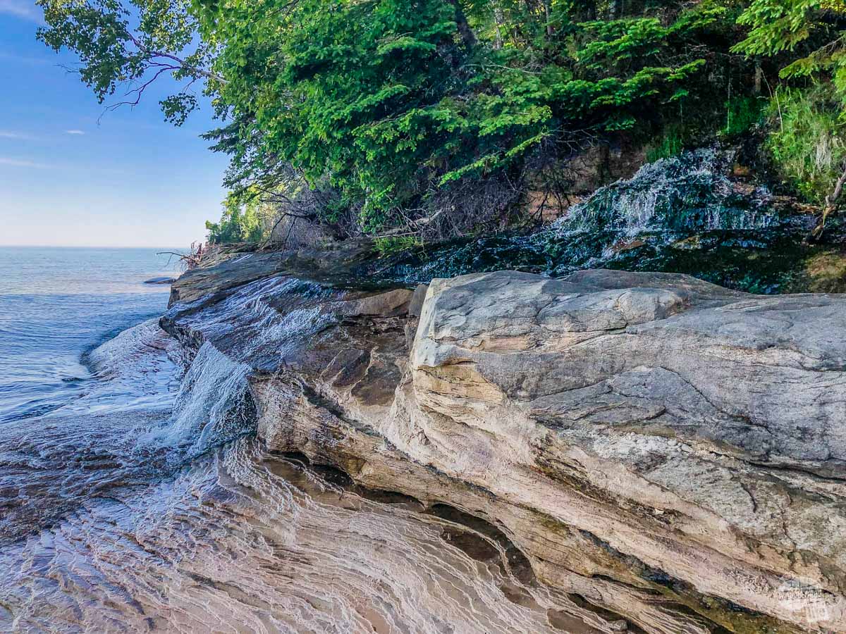
While you’re at the visitor center, be sure to take the short walk to Munising Falls. This may not be one of the most impressive waterfalls, but it is nice, especially with high water flow in the spring and early summer. I am fairly certain this is the easiest waterfall to reach within the park.
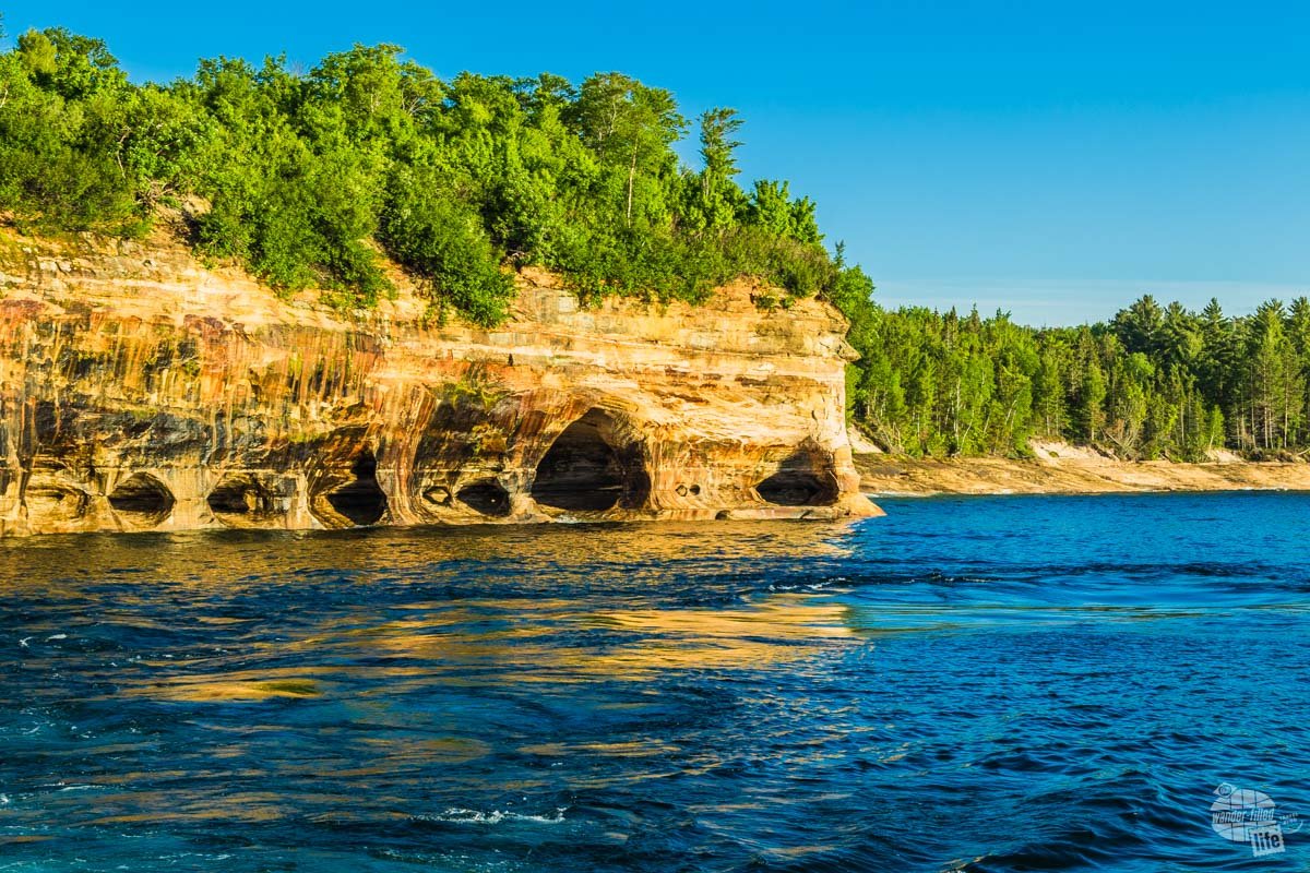
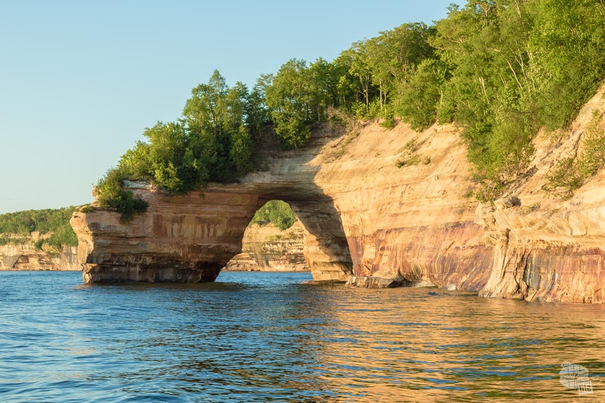
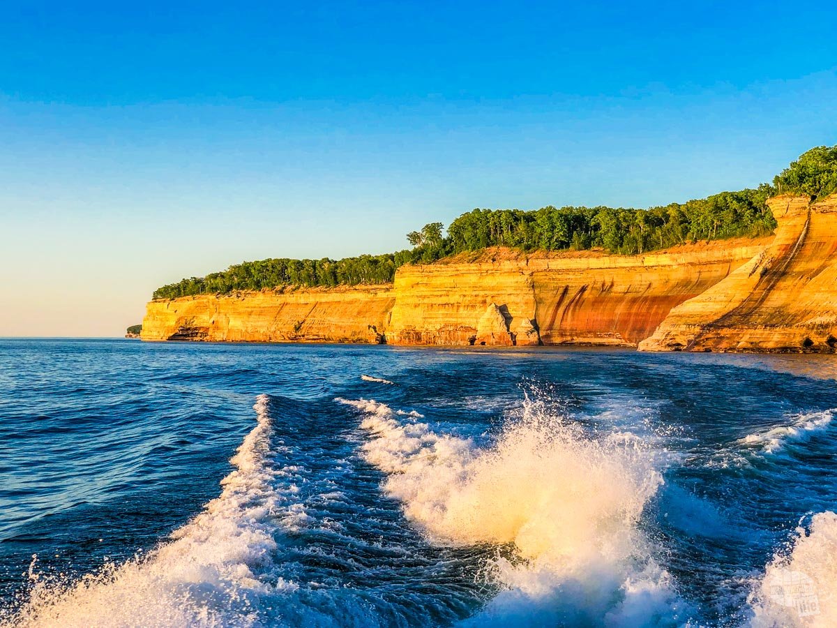
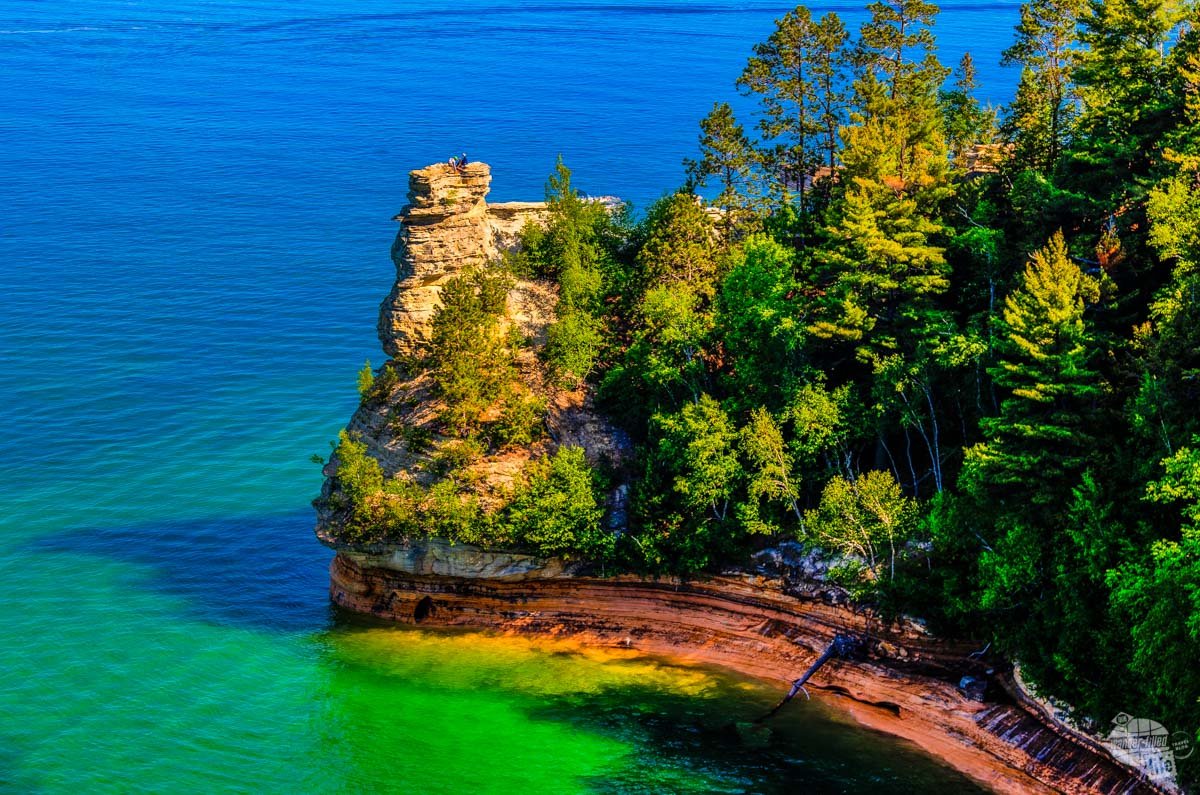
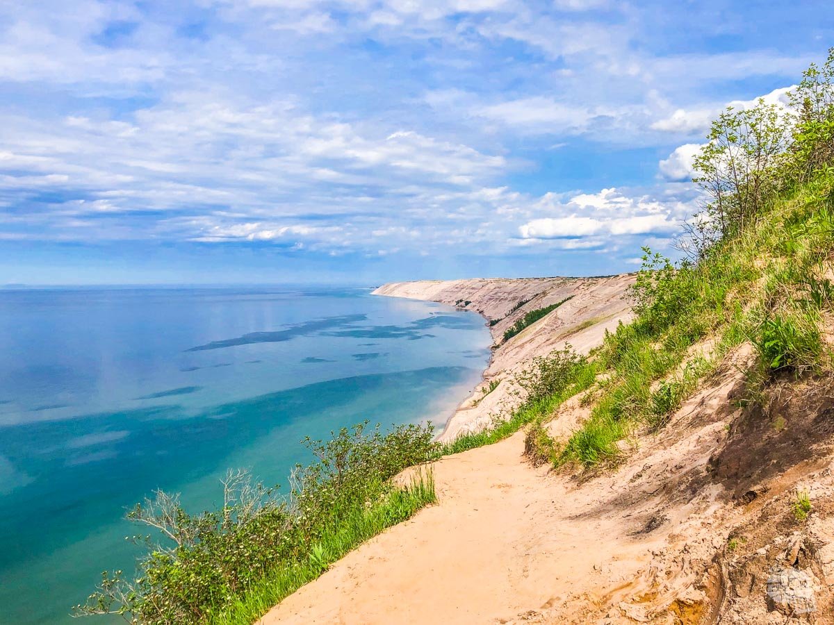
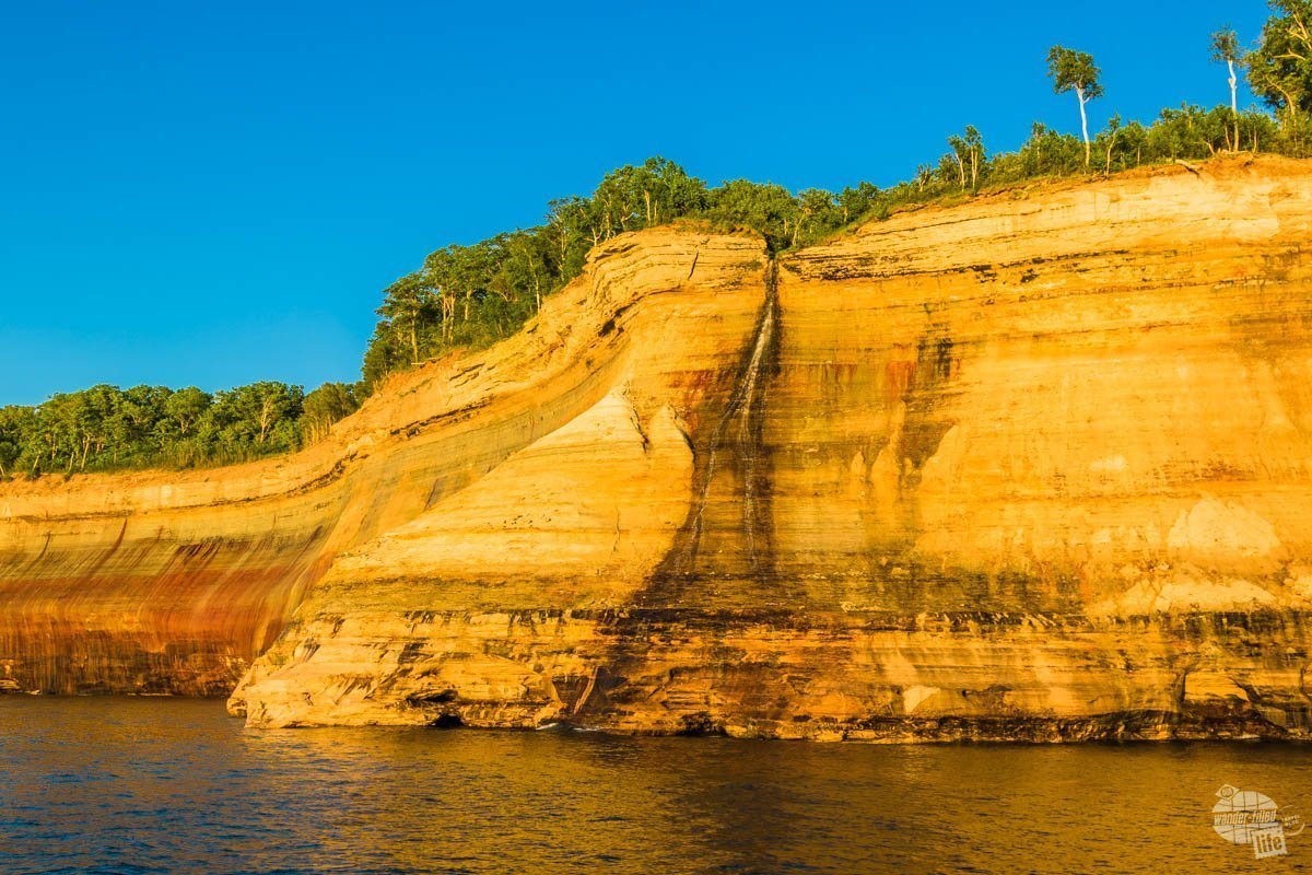
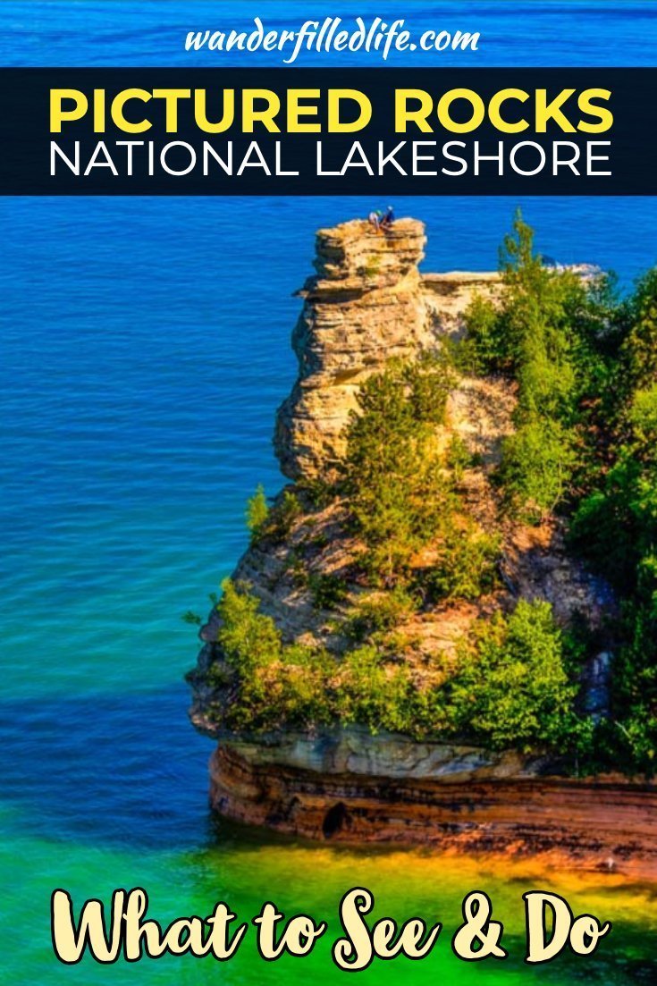
The lakeshore includes about 12 miles of sandstone cliffs, which is where you find the “pictured rocks.” Between the blue-green water and multi-colored cliffs, this is the most scenic area of the park.
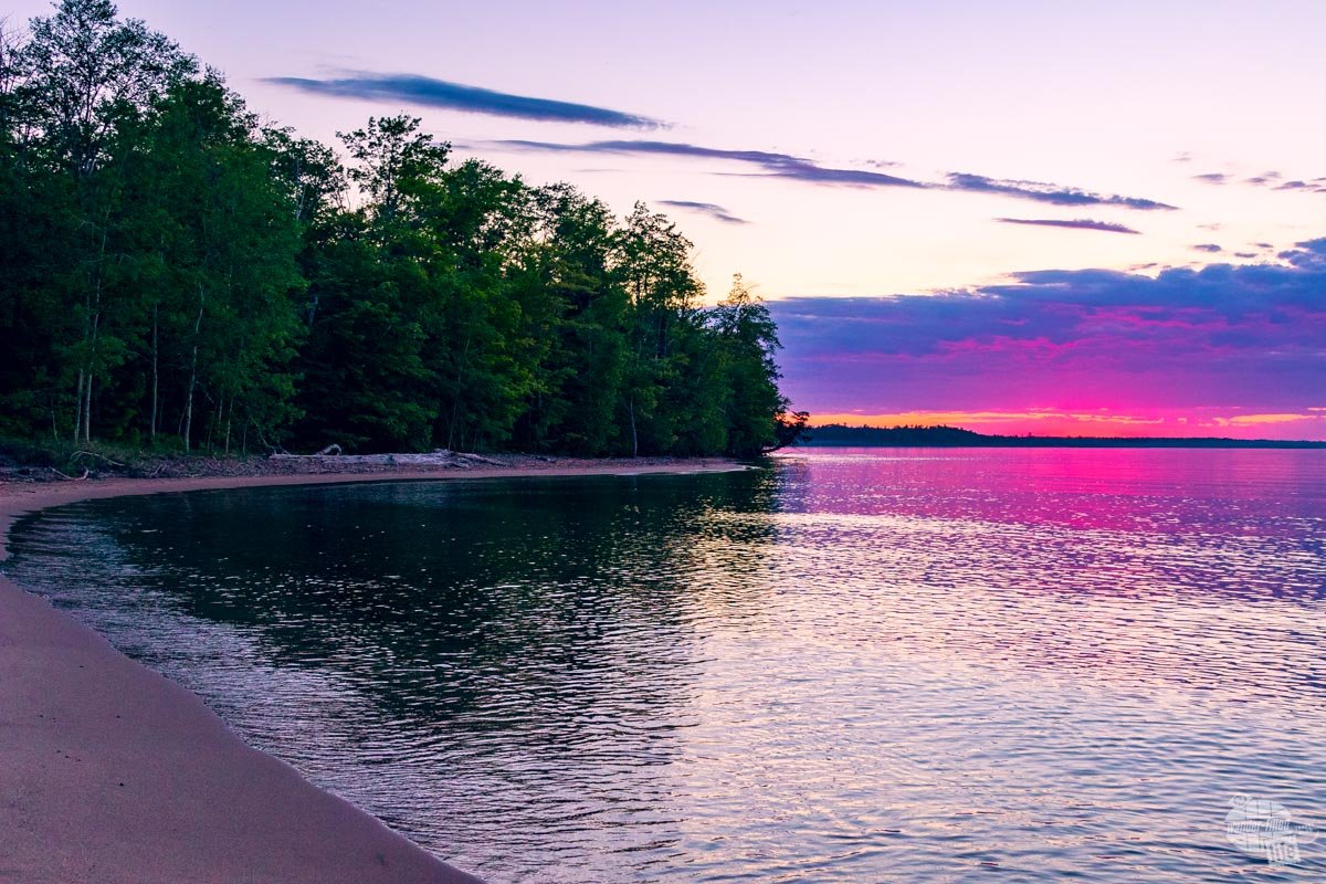
Further east lies Twelvemile Beach, which is exactly what it sounds like. You can access the beach from a few different hiking trails or a picnic/trailhead parking area. East of the beach you’ll find one of the lesser-known features of Pictured Rocks NL, the sand dunes.
At the east end of the park lies the tiny town of Grad Marais with the seasonal Grand Sable Visitor Center.
Viewing the Pictured Rocks
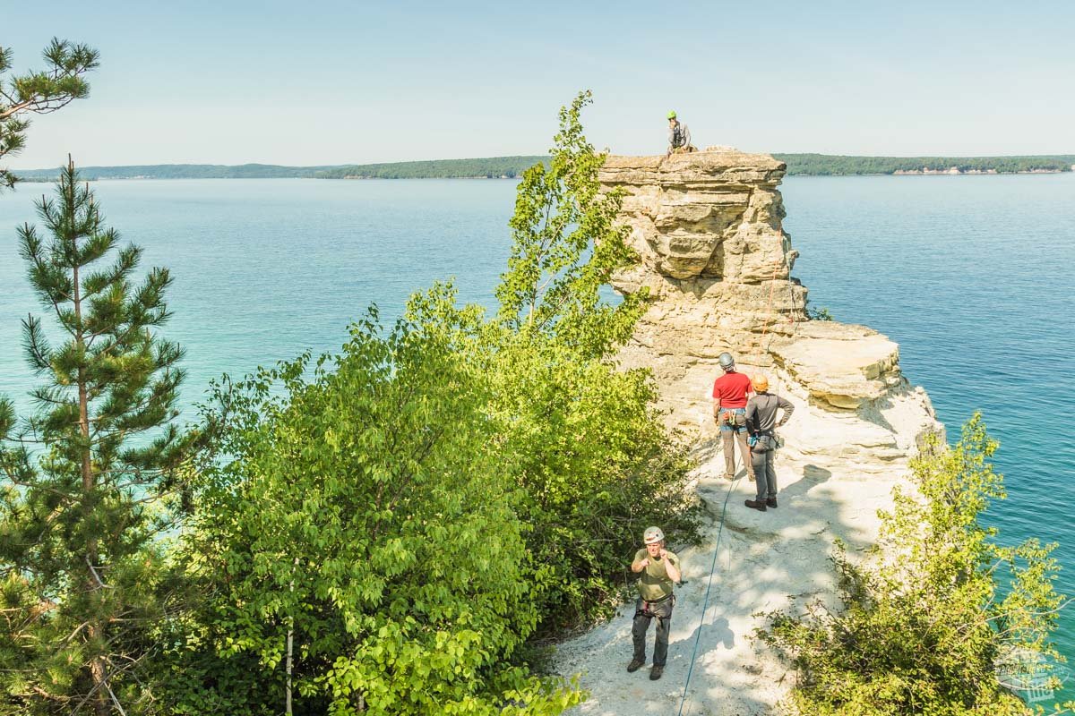
The absolute best way to see the namesake pictured rocks is from the water. There is a scenic overlook at Miners Castle, but you, obviously, get a limited view from this one spot. If you really want to see the variation in the rocks, you’ll need a kayak or a boat. It’s ok if you don’t have your own, though!
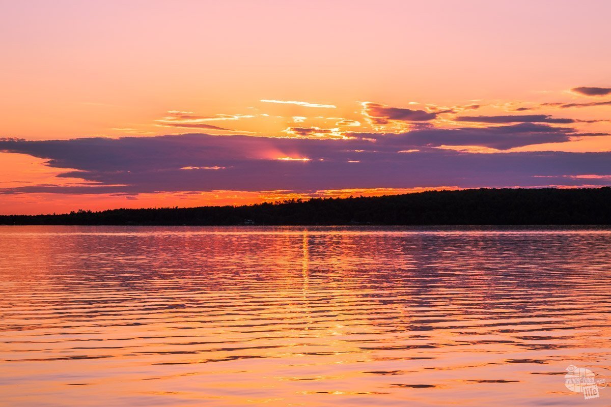
Perhaps the most popular way to view the pictured rocks is through a boat tour with Pictured Rocks Cruises. We took the sunset Spray Falls cruise, which I highly recommend. There are a couple of other cruises offered; check the web site for information and pricing. The timing of the sunset cruise was perfect for both the weather and the light.
As the captain navigated the boat east along the shoreline, he provided information on the formation of the cliffs, the science behind the wide array of colors and general information on the various features. We spent roughly an hour traveling east, all the way to Spray Falls, before turning around to return to the dock.
Pro tip: If you do this cruise, be sure to arrive early to grab a good seat (I’d say 45 minutes to an hour before the sail time). We recommend putting the photographer on the port (left) side of the boat. That way you can enjoy the cruise as it goes out and you’ll have better light for your photos on the way back, at least in the summer. Be sure to check sunset time versus the sail time.
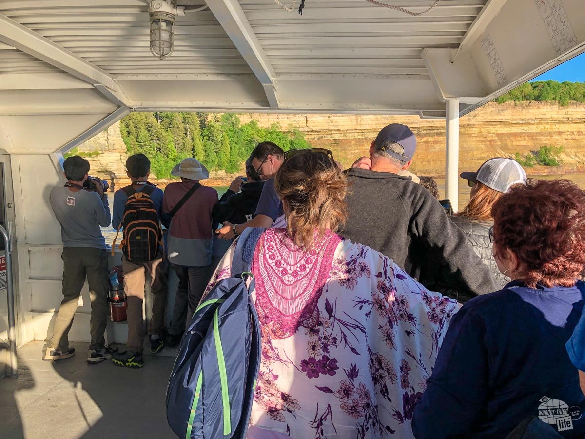
We lined up later than we should have and Grant was forced to stand at the back of the boat most of the trip to get good pictures. It is important to note that while the best seats are on the top deck, you cannot stand there. So, only those with seats along the rail will get unobstructed pictures.
Pictured Rocks NL Scenic Stops
For those exploring Pictured Rocks NL from land, which I encourage everyone to do, the scenic stops are accessed from Highway H58. To drive straight across would take about an hour. If you’re stopping along the way, you’ll probably want to give yourself at least half a day. Add additional time if you want to do any hiking.
On the west end of the park, the highway is roughly 5 miles from the coast. As you travel east, the road turns closer to the shoreline before pulling away again. Most of the scenic stops are well-marked, so just follow the park map and watch the signs.
Miners Castle
Driving east from Munising, the first scenic stop is at Miners Castle. This is an absolute must-do! There are two overlooks at Miners Castle along with a small exhibit area and some picnic tables. On a nice, sunny day you’ll see the blue-green jewel tones of Lake Superior against the rugged sandstone formations and coastline easily. This truly is one of the most picturesque stops in the park.
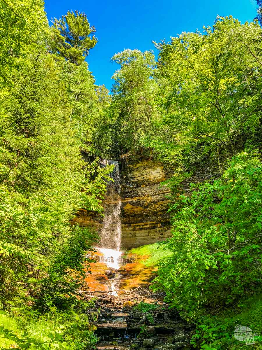
For a little beach time, head over to Miners Beach, just east of the overlook. We actually followed the advice of the ranger and parked at the North Country National Scenic Trail parking lot so we could hunt for a small lakeside waterfall here. From the trail parking lot, head down to the beach and turn right. You’ll have to scramble over some driftwood and maybe dodge a few small waves lapping the shore. Just past that you should see Elliot Falls, which flows right into Lake Superior. This isn’t a big waterfall, but it is a nice little hidden gem.
If you’re up for a quick hike, take the side turnoff for Miners Falls Trail. This relatively easy trail is about 1.2 miles roundtrip (out-and-back) to the waterfall. At the end of the trail, you will want to take the stairs (about 50 of them) down to the lower viewing platform. While the trail feels mostly flat on the way to the waterfall, you’ll likely notice the slight uphill on the way back. Overall, this is an easy hike that most anyone should be able to do. We spent about 30 minutes hiking and enjoying the waterfall.
Unpaved Roads
Back on H58, continue east. If you’re looking for easy shoreline access, you’ll have to drive quite a while. Along the way, you’ll pass a few unpaved roads. One, Chapel Road, leads to a great hiking area at Chapel and Mosquito Falls (more on this below). Others lead to Little Beaver Lake and the Beaver Basin Overlook.
Looking for a scenic overlook, we tackled the 3-mile road out to Beaver Basin Overlook. Unfortunately, it was a bit of a letdown, especially with the condition of the road. This was a quiet, secluded area with one lone picnic table. Sadly, the overlook was unimpressive.
I’d skip this unless you just want to get a little mud on your tires, which Grant always enjoys.
Twelvemile Beach
I’m going to be honest, we didn’t actually stop at Twelvemile Beach. We did a 6-mile hike at Chapel Falls (see below) and were wiped out after that. With clouds rolling in and the temperature dropping, we just weren’t interested in hanging out on the beach. In addition to the beach, there is also a 2-mile nature trail here. Maybe we’ll stop here if we ever return to Pictured Rocks NL.
Lake Superior Overlook
Our next stop was the Lake Superior Overlook. There’s not much here other than the overlook, a trail down to the beach and a pit toilet. We spent a few minutes at the overlook and moved on. I didn’t see much point in taking a trail down to the beach when there are easier access points elsewhere.
Hurricane River
This is another stop that we skipped that will definitely be on our list of things to do in Pictured Rocks National Lakeshore if we ever return. There is a picnic area and campground here, but the real draw is the trail to the Au Sable Light Station. A 3-mile roundtrip trail takes you out to the lighthouse.
According to the trail description, “exposed shipwreck remains dot the shoreline.” If you time your hike right, you can also get a tour of the lighthouse.
Log Slide
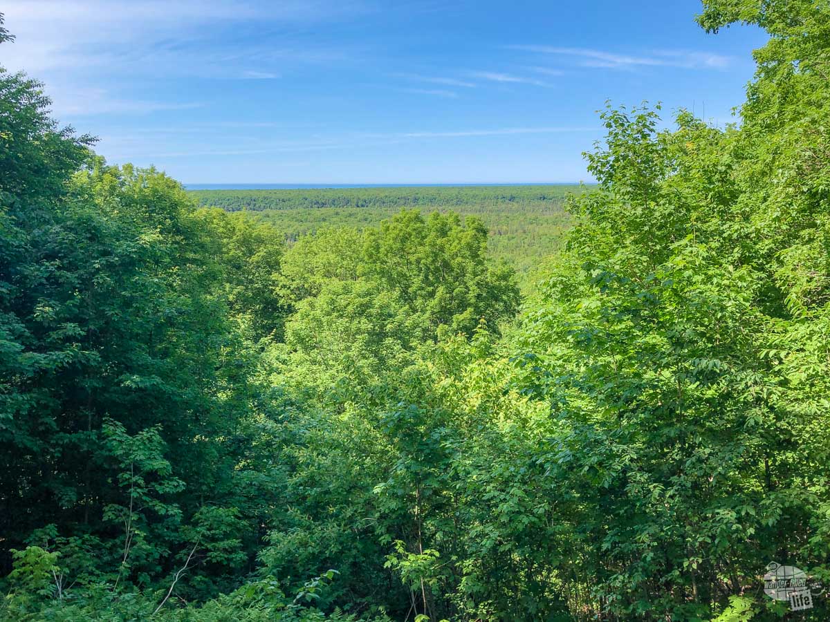
Our final stop was at the Log Slide Scenic Overlook. This is a great stop if for no other reason than to actually see the sand dunes at Pictured Rocks. A short walk takes you past some old logging equipment and then up to the top of a high dune.
From the top, you can easily see that this is a perfect hill to slide logs down to the water for transport. The old chute is gone, as is the overlook platform. Still, it is easy to take in the dunes and the log slide hill from the sand.
I’ll also suggest following the path around towards the coast and to the right just a bit to get a look at the other dunes farther east.
If you’re really brave, you can walk (or run or, likely, stumble) down the hill to play in the sand. Just remember, the walk back up is a lot harder than the walk down. The warning signs from the park service were enough to keep us at the top but we did see plenty of people playing in the sand down the hill.
Other Stops
As you continue east toward Grand Marais, you’ll reach the Grand Sable Visitor Center and Sable Falls. The visitor center closed before we got there and, honestly, by that time a beer sounded way more inviting than another waterfall.
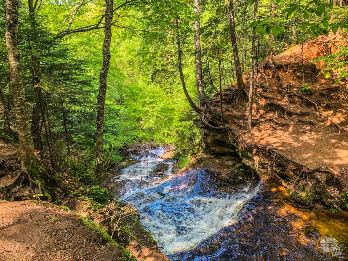
Pictured Rocks Hiking: Mosquito Falls & Chapel Falls
For those wanting to do some longer hiking at Pictured Rocks, the Mosquito & Chapel Hiking Trails are your best option. This area is found about 8 miles east of Miners Castle Road. First, though, you have to drive down the 4-mile Chapel Road, a fairly rough unpaved road.
We saw all kinds of vehicles parked at the trailhead here, but we were thankful to be driving our F-150. The high clearance definitely made the drive a bit less stressful.
From the trailhead, there are a variety of options for both short and long hikes. Mosquito Falls is about one mile from the trailhead. Chapel Falls is about 1.2 miles in the other direction. To see both, you’d be looking at about 4.5 miles all together at a minimum. If you’re really serious about hiking, you could see both on a 10-mile hike.
Several trails combine to create loops on each side of the trailhead as well. There really are a lot of options here… Be sure to pick up a free trail map at the Visitor Center if you are planning on hiking at Pictured Rocks NL.
Check out our 10 essentials for hiking here.
Chapel Falls Loop
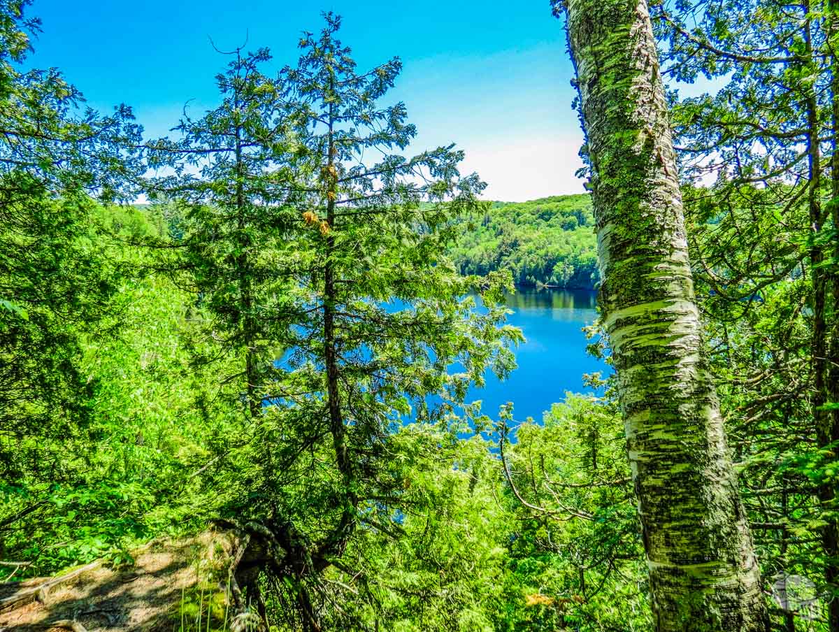
We chose to do the 6-mile loop that circles Chapel Lake and passes Chapel Falls. Hoping to save the easy part for the end, we opted to hike clockwise from the trailhead. Thankfully, we made a good decision! The hike straight to Chapel Falls really is not too bad. On the other side of the lake and the waterfall, the trail was often a muddy mess.
With our routing, we hiked about 3 miles before we go to Chapel Beach. While the trail was fairly flat and well-marked, there were some extremely muddy spots. Once at Chapel Beach, we ate a picnic lunch and watched a few boaters in the water below.
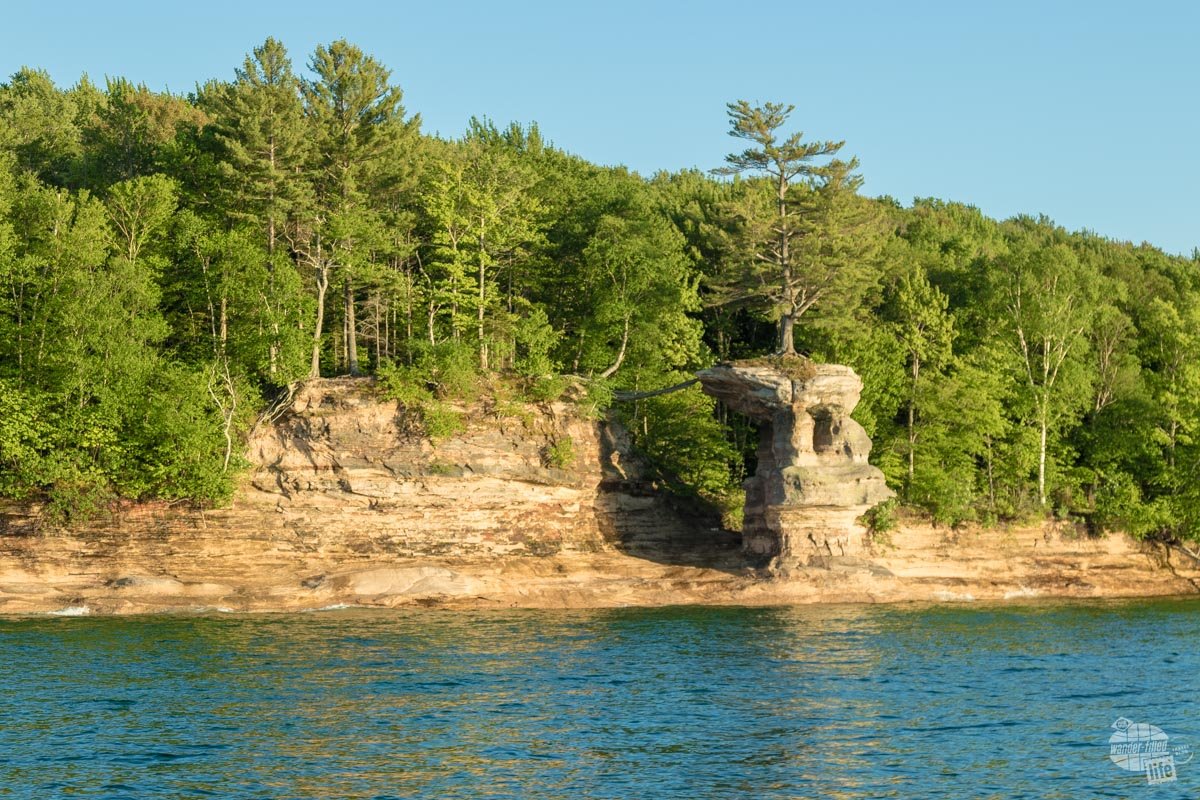
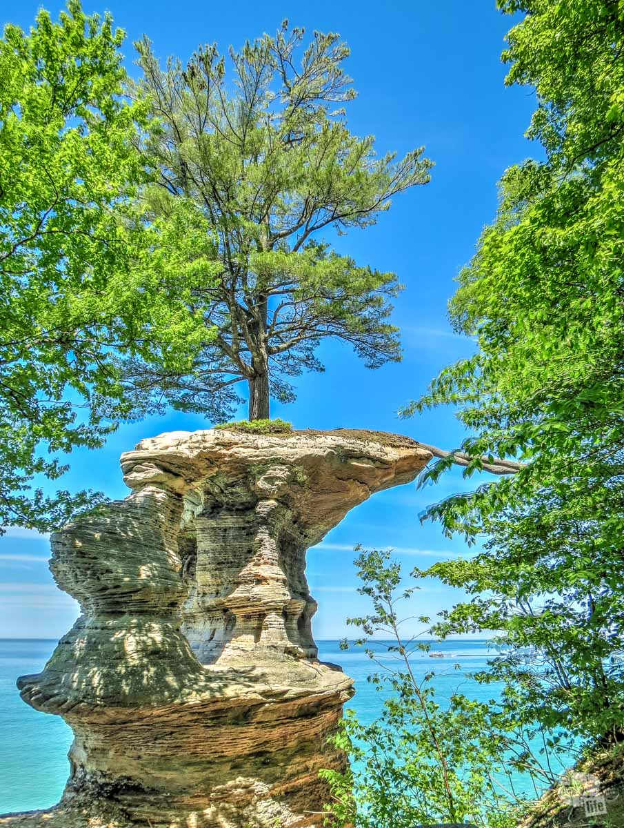
After lunch, we continued about a 1/2 mile along the coastal trail (North Country NST) towards Chapel Rock. We saw this rock from our boat tour and were excited to see it again up close. Somehow, this one tree is growing on an island rock formation with its roots stretching across to the mainland. It really is quite unique and interesting.
From there, the trail turns inland taking you to Chapel Falls (about 2 miles from the coast). Again, along the trail from the coast to the waterfall, we encountered quite a bit of mud. We thought most of the mud was from an abundance of recent rain. The alternate trails were quite well defined, though, so it must be at least a somewhat common problem.
Thankfully, from Chapel Falls back to the trailhead was a lot better, with very little mud and a fairly smooth trail.
Despite the mud, we really enjoyed this hike. Seeing Chapel Rock up close was a highlight. The entire loop took us almost 3.5 hours and my Apple Watch measured 6.8 miles total.
Where to Stay Near Pictured Rocks NL
If you’re looking for camping near Pictured Rocks National Lakeshore, there are only a few options. We chose the relatively new Pictured Rocks RV Park and Campground. The campground is located about 10 miles west of Munising in the tiny town of Christmas.
Pro tip: If you are headed west from Munising, slow down once you pass the casino. The campground sign is off the highway a bit and we missed it the first time by.
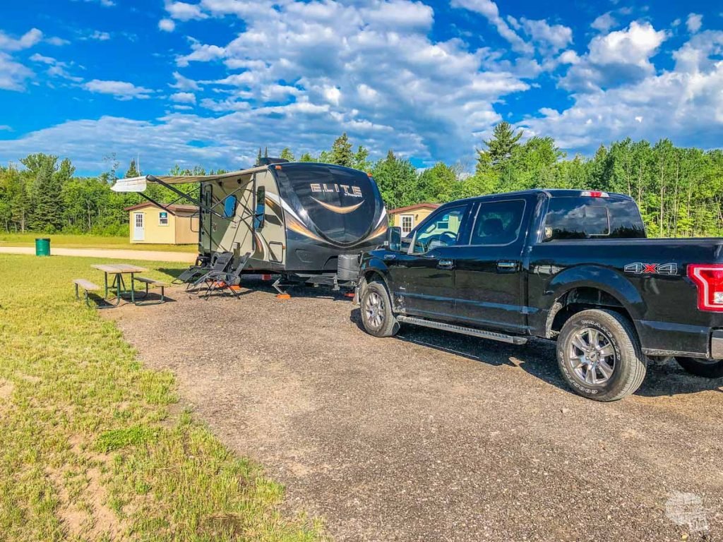
As a new campground, you won’t find a ton of bells and whistles. There are no laundry facilities, all the interior roads are gravel and there are no trees. All that aside, this is a fabulous campground which we definitely recommend.
All the back-in sites are long enough for even the biggest Class A RVs and a tow vehicle. The official outlined sites are nice and wide with plenty of grass surrounding. With no trees, there isn’t a lot of privacy, but we still felt that we had our own space.
You can read our full review of Pictured Rocks RV Park and Campground here.
If you’re looking for camping near Pictured Rocks NL, this is a great option. For those interested in a hotel room, you have several options in Munising. I definitely recommend staying in Munising over Grand Marais.
Where to Eat Near Pictured Rocks
We cooked a lot while we were here (that’s one thing we love about having an RV!) but we did visit a couple of restaurants.
Lake Superior Brewing
After our day of exploring and hiking in Pictured Rocks National Lakeshore, we stopped at Lake Superior Brewing at Dunes Saloon in Grand Marais. It was obvious that this is a favorite among locals and visitors alike. Then again, options are quite limited in this tiny town.
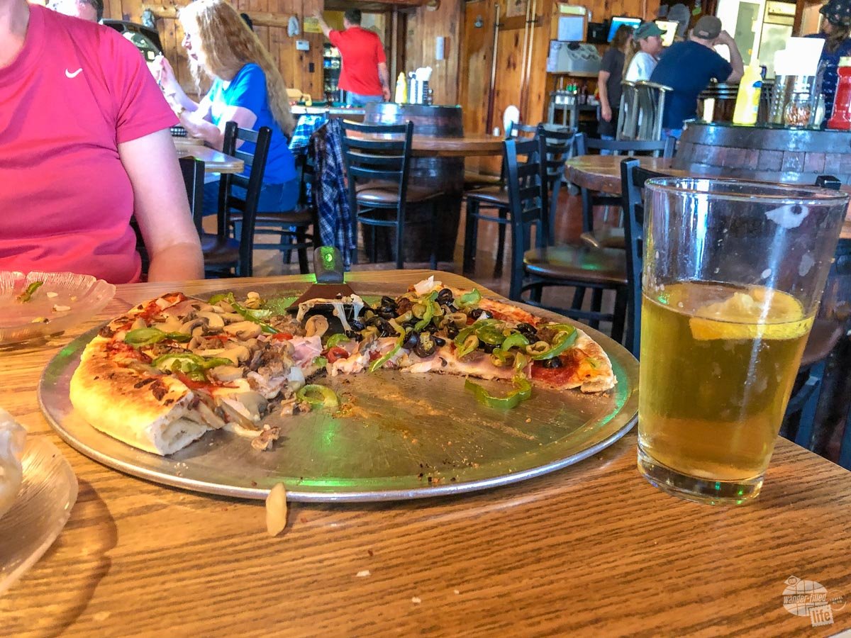
Our waitress suggested the appetizer special, a homemade red pepper hummus topped with Mediterranean salsa. I have to say, we were quite impressed with this dish! The fried pita chips for dipping were a bit unusual, though not bad. For dinner, we got a large pizza. Even though we were both starving, after the hummus we ended up taking about half the pizza home.
The beer was good, though nothing to get excited about. Mostly, we just enjoyed visiting a local brewery/restaurant and trying out something new at the end of a long day.
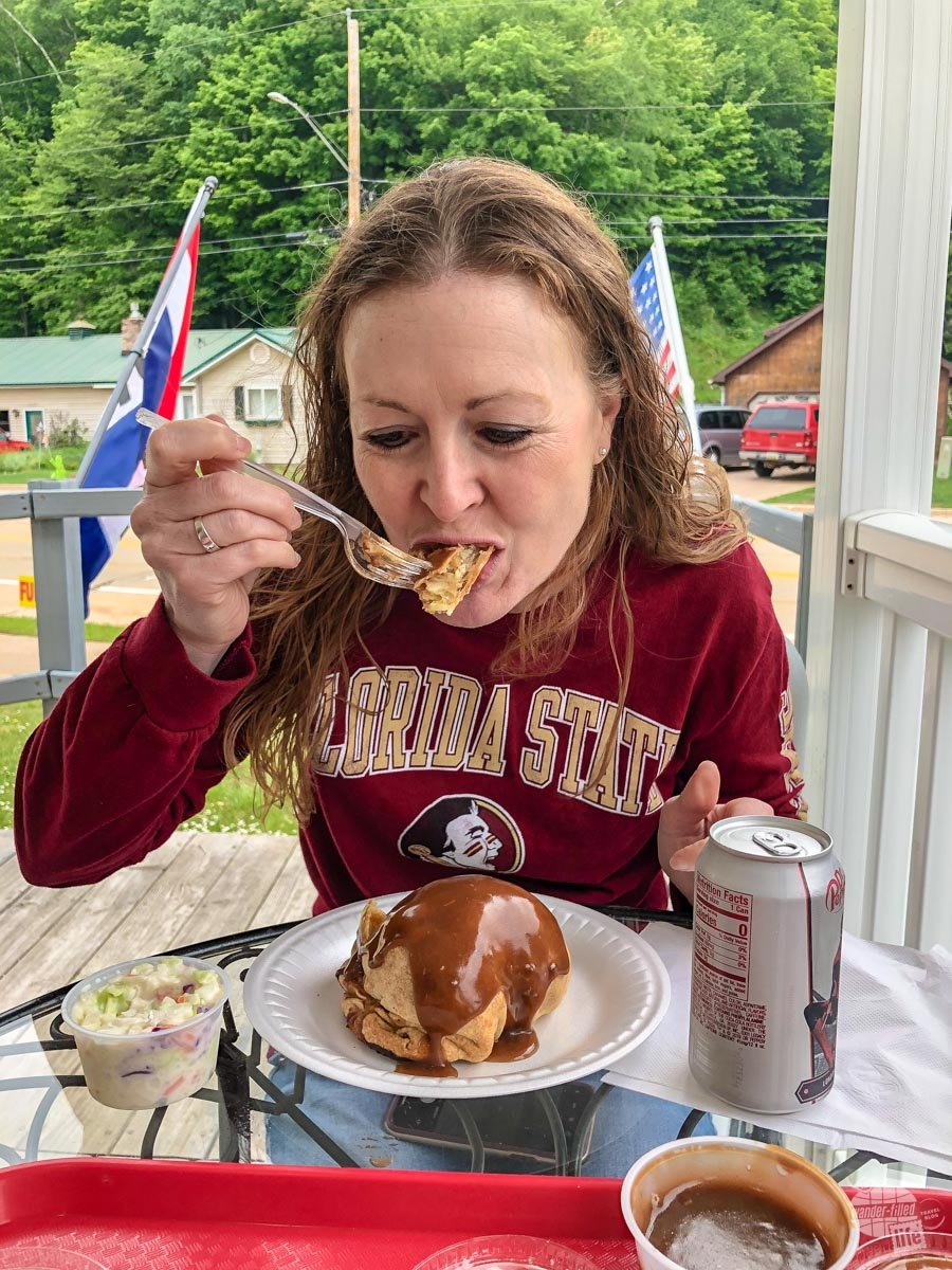
Muldoons Pasties
Apparently, the regional specialty food in Michigan’s upper peninsula is a pasty. According to this article on NPR,
Outside the rural Midwest, the term “pasty” is associated with a particular type of nipple cover rather than a pastry shell stuffed with ground beef and root vegetables, although the pronunciations of these terms differ. The food variety, ironically, rhymes with “nasty” rather than “tasty.”
Erin Wisti, NPR
Seeing as we’d never had a pasty before, we figured we should try one while in the UP. As such, we stopped at the award-winning Muldoon’s Pasties & Gifts in Munising. Your basic options are beef, chicken or vegetable and with or without gravy. You can also get coleslaw and drinks. The menu is fairly basic; you definitely will not be overwhelmed with options.
After ordering a chicken pasty for Grant and a beef pasty for Bonnie, along with gravy, coleslaw and drinks we headed to the outside tables to chow down.
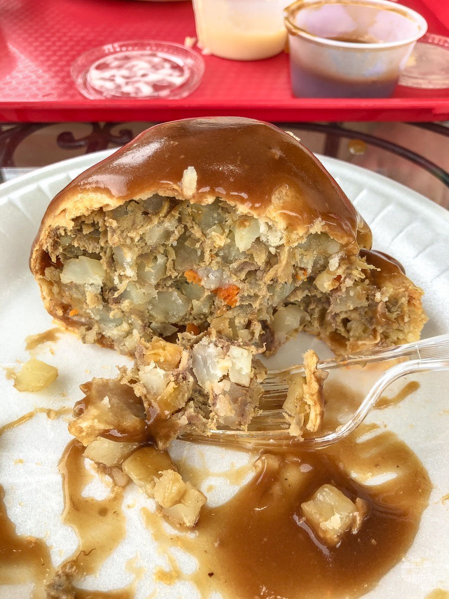
Have you ever had a chicken pot pie? That’s what a pasty is, just handheld instead of in a little dish. It wasn’t bad. It just wasn’t anything to get overly excited about. I am confident that the gravy did make it better, though, so be sure to add the gravy.
Muldoon’s was our only stop for pasties, so we have nothing to compare it to. I’d definitely say you should try one somewhere in the UP since it is clearly a favorite dish here. That said, if you miss your opportunity, you really aren’t missing much.
Final Thoughts on Pictured Rocks NL
Pictured Rocks National Lakeshore is certainly a unique geological area. The best way that I can describe it is as a coastal version of badlands. The rainbow of colors formed by the various minerals over time is outstanding. The wearing away of the sandstone to create unique formations is almost unreal.
Having colorful sandstone cliffs, sand dunes and beaches all in one short stretch of coastline is incredible. That, combined with the vastness of Lake Superior truly is something special. We enjoyed not only the natural beauty but also the fabulous late-June weather and the small town remoteness of the upper peninsula.
We spent about a day and a half exploring and doing the boat tour of Pictured Rocks. While we did skip a few things on the eastern end of the park, overall we felt as though we saw what we needed to. We thought about going back to the eastern end but the driving in this area of the world is not super exciting, and it just didn’t seem worth it… Especially since we had just recently visited Indiana Dunes National Park and Sleeping Bear Dunes National Lakeshore.
With plenty of things to do at Pictured Rocks, if you aren’t planning a trip yet, you should!
Check out our full Great Lakes National Parks itinerary here.
Travel Resources
What do you use to find a flight?
We use Skyscanner to find deals on flights. Skyscanner has a great interface and compares tons of airlines for the best pricing and routing. That said, it does not always have every airline and some airlines will have better deals on their website. Still, Skyscanner is a great place to start.
Click here to search for a flight.
What do you use to find a hotel?
We typically stay at Hilton properties, so we use the Hilton website. You can find good Hilton Honors discounts or AAA discounts for a hotel there. We make great use of our free night certificates from our Hilton Honors American Express.
Click here to book a Hilton property.
If there are no Hilton properties available, we use TripAdvisor to read reviews and book the hotel. We find we can get the best price that way.
Click here to search for a hotel.
We recently partnered with Stay22 to add interactive maps to each of our destination posts. This will allow you to see a plethora of hotels and vacation rentals all in one responsive map of the area.
What if I need more space than I can get at a hotel?
We use Vrbo for the times when we have rented a cabin for a weekend getaway, like this cabin in Townsend, TN, or needed to rent a house for a large family vacation. We had a great experience with them in terms of refunding deposits when COVID hit and will continue to use them.
Click here to search for a vacation rental.
Who do you use for rental cars?
As a general rule, we book with Hertz for rental cars. We have had nothing but good experiences with them. Plus, we really like unlimited mileage and not worrying about crossing state lines. We have even rented from Hertz overseas in both Slovenia and Croatia.
Click here to book a rental car.
How about booking a cruise?
We have found some amazing prices for booking a cruise through Cruise Direct. We have saved a lot of money on our cruises compared to what we found elsewhere, making a last-minute Bahamas cruise even cheaper.
Click here to book a cruise.
What if I want to rent an RV?
We highly recommend Outdoorsy for RV rentals. We rented a camper van for a week to visit Rocky Mountain National Park for the elk rut and Custer State Park for the Buffalo Round-Up and had a blast. The program was easy to use and we really enjoyed the freedom of having a camper van for that trip.
Click here to rent an RV.
What do you use for booking tours?
We don’t often book tours. Typically, we like to do stuff on our own. That said, there are some experiences you can’t have any other way. So, when we do want to book a tour, we always check Viator first.
Click here to book a tour.
Do you use anything to get discounts on the road?
We make extensive use of both Good Sam and AAA on the road. Good Sam is normally regarded as a discount card for RVers at campgrounds and Camping World but anyone can use the 5 cents off a gallon at the pump at both Pilot and Flying J.
Click here to get a Good Sam membership.
We have had AAA as long as we have been married and it has more than paid for itself in discounts at hotels, aside from the peace of mind of having roadside assistance. Add in paper maps and the ability to get an international driver’s license and it is more than worth it for any traveler out there.
Click here to get a AAA membership.
Bonnie, I really like your detailed descriptions on what to do. And how far the trails are and what the trails are like.
I am sure that pasties were developed by hunters who cooked out in the woods. My family has a huge past as hunters going to the Up hunting game. It is close to what boy scouts and girl scouts were taught when doing over night camping trips and wrapping the meet and vegetables in aluminum foil, freezing it, for hiking trips through the wilderness. At night, build the fire, put food next to to the hot coals, keep turning so it does not burn, then unwrap and eat. Not much clean up. The pasty just preserves the food in a dough rolled out, then filled with meat and vegetables. I prefer making my own because I can filled it with the vegetables I like to eat.
I will be watching future posts because I like all of the details you provide.
Fellow travelers Sue
Thanks, Sue! Glad my information is helpful – we always aim to provide as much info as possible. I do love the “all in one” convenience of a pasty, especially when camping!
Great post! It is always nice when someone does the homework for you! I love the pictures too!
Thanks so much!