
Last Updated on February 19, 2024 by Grant
So, you’ve packed your bags and you’re ready to hit the road! Or are you? While road trips are a lot of fun they can also be challenging. If you’re not properly prepared you might find yourself lost, frustrated or hangry; none of which are fun, I promise! Don’t worry, though, we’re here to help you prepare with our list of road trip essentials.
Yes, you’ll need basic clothes and toiletries. For this article, I’m going to assume that you can handle packing your bags. What we’re going to focus on are some of the little things that you might not think about before heading out on a road trip.
Grant and I have been road-tripping for more than 10 years. We’ve done short trips (3-4 days) and long trips (6-7 weeks). There have been road trips in the summer and winter. We’ve stayed in hotels, tent camped and taken road trips with the RV.
Through all this, we’ve made plenty of mistakes and learned quite a few lessons. We’ve also had some very memorable moments and explored some amazing and unique places. Whether you are planning your first road trip or are looking to make the next one a bit more enjoyable, preparing yourself with these road trip essentials is the key to a great vacation.
(Disclaimer: When we link to places where you can buy our stuff or places we stayed, we are using special codes that earn us commissions on the sales at no additional cost to you. Please see our Review Policy for more information.)
Pick The Right Vehicle
Yes, I’m starting with a big one! The best road trips will come with the right vehicle. No, I’m not saying you need to rush out and buy a brand new car before your next trip. That said, if you know that you enjoy road trips, making sure you have a vehicle that is up to the challenge is essential.
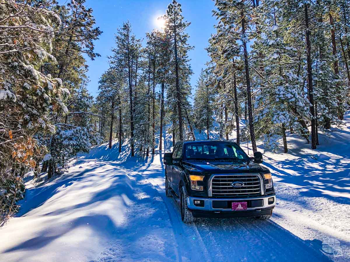
We have road tripped in four different vehicles: a Ford Explorer, Edge and two F-150s. While the model has changed one thing that all these vehicles had going for them: plenty of space and comfort.
When Grant and I started dating, he was driving a Jeep Wrangler. While he loved his Jeep, it really was not a good road trip vehicle. It had poor fuel economy, not much cargo room and, honestly, was an uncomfortable ride over long distances. That’s why we took my Explorer for our first few road trips.
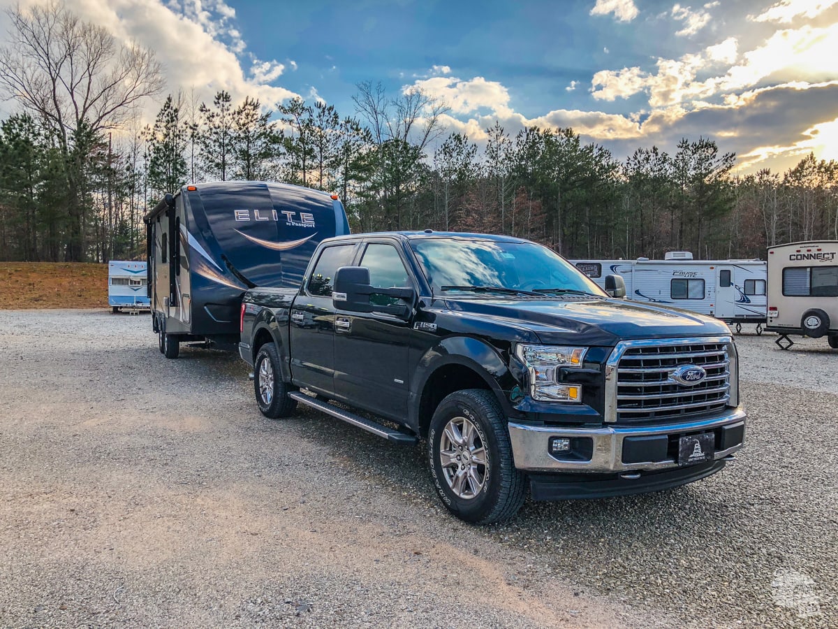
After the Jeep died, we decided to not replace it and (somewhat by accident) became a one-vehicle household. We initially got a truck because we needed the bed when Grant was teaching drama and had to frequently visit Home Depot for lumber to build the sets. Once we got a camper, we also needed the truck for the tow capacity.
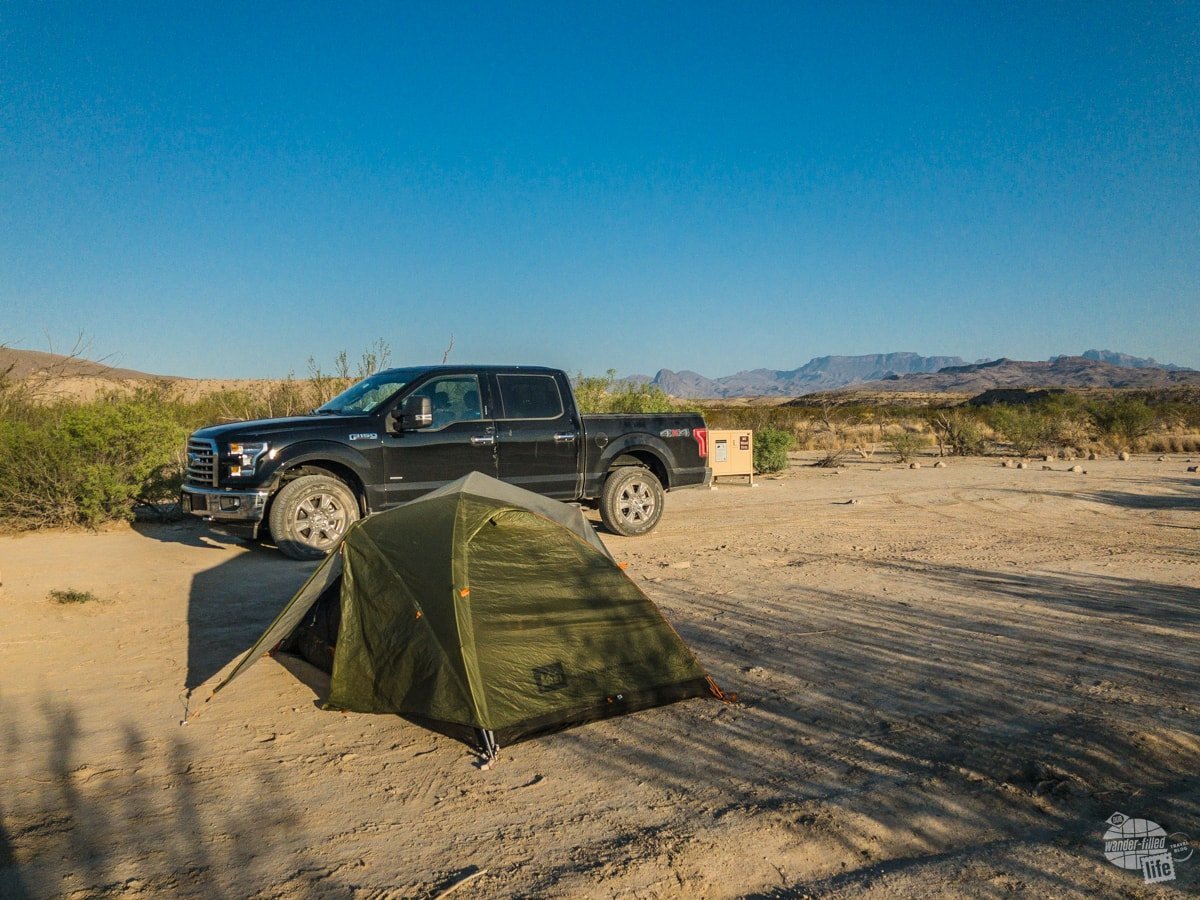
Overall, we have really enjoyed both of our F-150s. Our current truck has a full double cab, which gives us more “indoor” space. We also have a lockable Retrax cover on the bed, which keeps our additional gear secure and mostly dry. We really like the extended fuel tank (36 gallons). That makes long distances out West easier to handle, like towing the camper across the Extraterrestial Highway in Nevada.
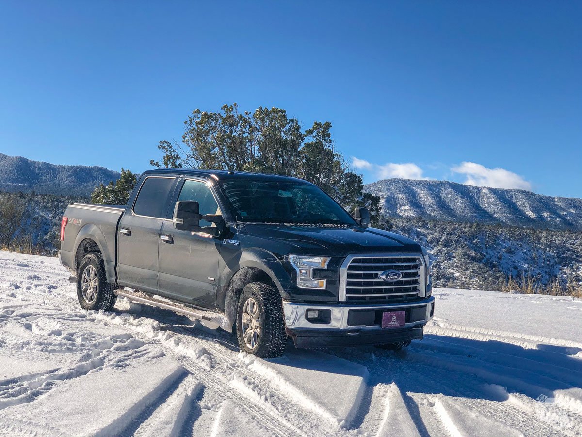
We also like that the truck has four-wheel drive. While that is not a must-have for most folks, we love being able to handle snow in the winter in New Mexico without a problem or drive the dirt roads in Big Bend National Park without difficulty.
Whatever vehicle you choose for road-tripping, make sure it is spacious, comfortable and reliable!
Read more about why we love road-tripping in the F-150.
An Organized Vehicle
Once you’ve made sure you have a comfortable and spacious vehicle, it’s time to get it organized. This is especially important if you’re taking a long road trip.
Depending on the vehicle, you may want a trunk or bed organizer. Also consider what you’ll want to keep easy to reach (laptop, charger, snacks) – those need to be in the backseat, within arm’s reach. Items you don’t need until you arrive at your stop for the night (suitcase, toiletries, etc.) can go in the trunk or just farther out of reach.
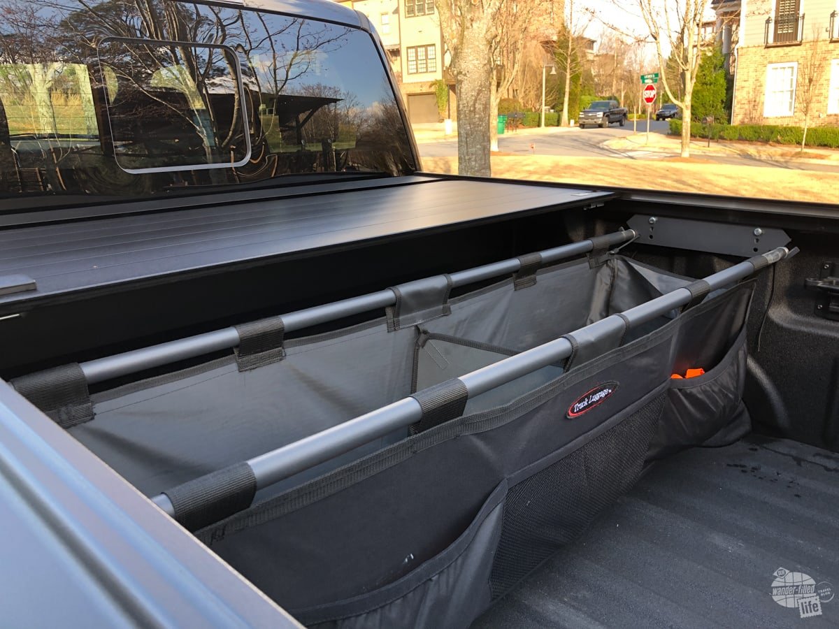
If you drive a truck and don’t have a tonneau cover, consider what can get wet or how secure from theft your stuff needs to be. Even with a tonneau cover, some are more secure and weatherproof than others. Pack your stuff appropriately. We use plastic bins for anything toward the back of the bed because it tends to get a lot wetter and dirtier toward the back.
We chose a Retrax Pro because it locks but it easily opens up to an open bed without removing anything. It is more expensive than a lot of other tonneau covers but the versatility was worth it to us.
On one winter trip to South Dakota, we made the mistake of putting all our heavy layers in the bed of the truck up towards the cab. That was great until a blizzard rolled through and the bed cover froze and we couldn’t get to those bags. Lesson learned the hard way!

- Fits 2021 – 2023 Ford F-150 (incl. Raptor/Lightning) 5′ 7″ Bed (67.1″)
- LEGENDARY VERSATILITY | Features overlander capabilities with our Trax Rail System and is compatible with virtually any T-Slot accessories allowing you to double your truck bed cargo capacity
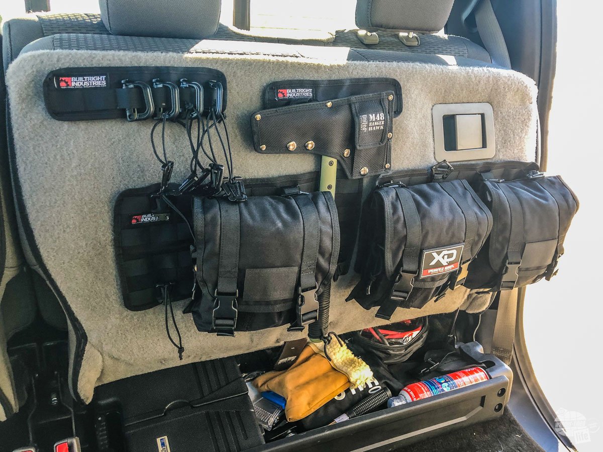
Inside the vehicle, we have a BuiltRight Industries Velcro Tech Panel System that attaches to the underside of the back seat. For the most part, this is where we store our emergency gear (more on that below), including our raincoats. At the very least, it gets most of our small stuff out of the way to make room for laptop bags, snacks and other things we need in an easy-to-reach location.
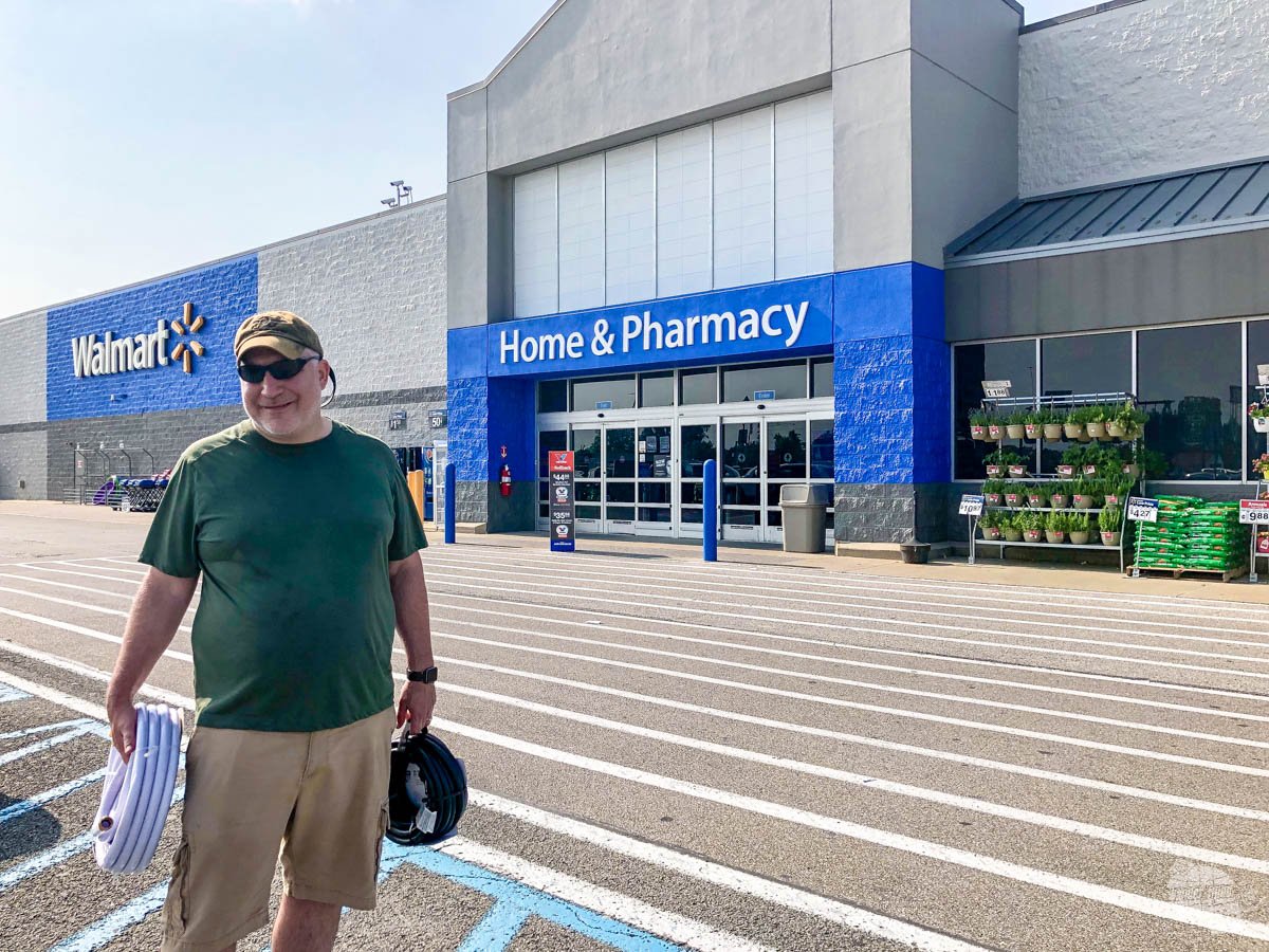
It may take you a couple of trips to figure out what works and doesn’t work. That’s ok. But, if you figure out after a couple of hours or a couple of days that you need to reorganize – do it! We’ve definitely hit up Walmart while on the road to buy new bins and organizational items.
Pro Tip: Having a dirty clothes bin in your trunk or truck bed keeps your smelly laundry out of the way and all in one place.
A Great Itinerary
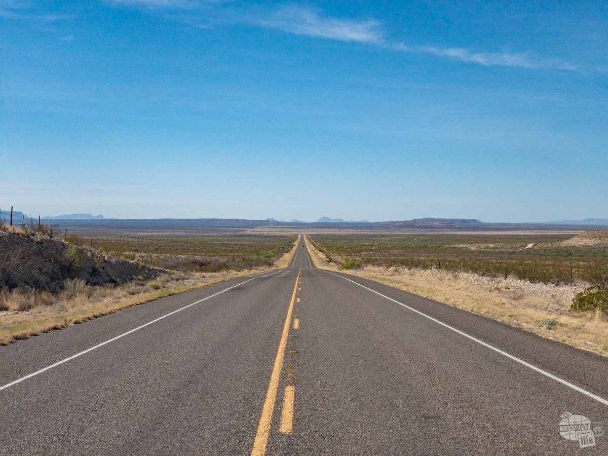
A great road trip is not so much about where you go as how you get there. Seriously, the best road trips involve multiple stops with no true “destination.” Yes, there are times that you may need to have a day or two of just driving with no scenic or fun stops. My advice: limit those as much as possible.
On our first RV road trip to New England, we included stops in Tennessee, West Virginia, Pennsylvania and New York on the way there and back. We took time to explore places like the Andrew Johnson National Historic Site, Harpers Ferry & Antietam and Gettysburg. On the other hand, when we drove to California in 2018, we didn’t explore at all until we got to Arizona.
Pro Tip: If you are planning a road trip in the East, look into getting an NC Quick Pass. That transponder will work 18 states east of the Mississippi.
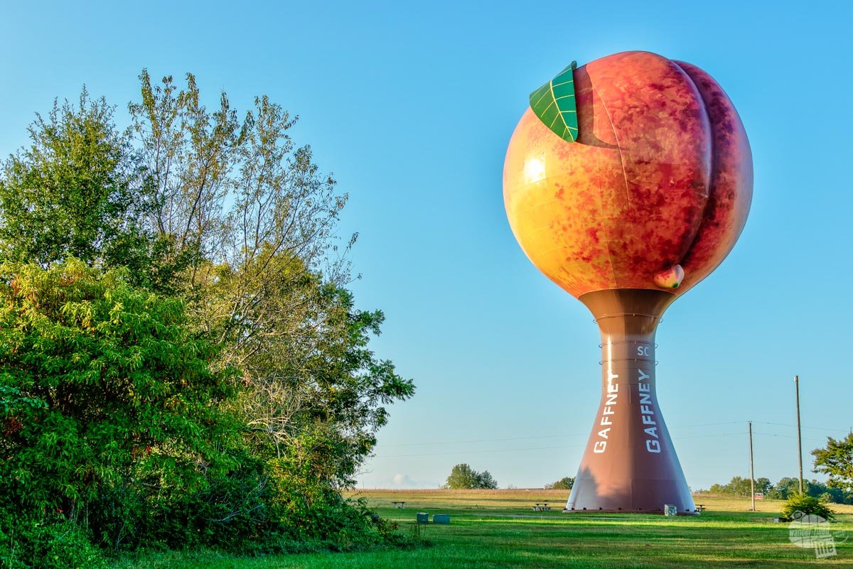
Figuring out exactly where to go and how to get there can be difficult – there are just so many great places to explore! When planning your itinerary, try to fit as many different stops as you can into one trip. Don’t be afraid to take the “long route” so you can stop at a random roadside attraction to break up the day. Even just driving by the “giant peach” in South Carolina can break up the monotony of a long day in the car.
If you really want to be spontaneous, you can head out without a plan. Just understand that with this approach, you may miss out on something you really wanted to see if you can’t get lodging. Yes, that’s happened to us a couple of times.
Need Help With an Itinerary?
Establishing some travel goals can help you plan trips over time – that may be to visit all 50 states, go to all the Major League Baseball stadiums or visit all the state parks in your state. Having any sort of goal, however big or small, will give you some sort of direction and keep you motivated in your travels.
If you need more inspiration, we’ve got several articles and itineraries you can check out:
- How to Plan a Road Trip
- Travel Goals
- Western National Parks Summer Road Trip Itinerary
- Washington National Parks Road Trip Itinerary
- Great Lakes National Parks Road Trip Itinerary
Plan Your Budget and Plan to Save Money
One of the pitfalls of just taking off on the open road is failing to set a budget. Travel is expensive and costs and pile up quickly.
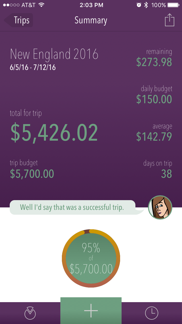
We highly suggest setting a trip budget. We use the app Trail Wallet to track transactions and keep a budget while on the road. It also helps us know what to expect on future road trips in terms of costs.
We also make a point to use our AAA membership and our Good Sam Membership for discounts. AAA offers discounts and many hotels, including Hilton properties where we usually stay if we aren’t camping. You will also find a good number of campgrounds with AAA discounts.
Good Sam seems like it is more RV and camping-focused but there is one key benefit a lot of folks overlook when thinking about Good Sam: $.05 off per gallon of gas at Pilot and Flying J. I only need to buy 15 tanks of gas per year and this membership pays for itself.
Read more on how we save money on road trips here.

Apps to Get You There and Help You Along the Way
Now that you’ve set your basic itinerary it’s time to make sure you have the exact directions. Thankfully, that is easier than ever with all the various navigation apps.
We used to rely on our phone apps for navigation. And we still do sometimes. There are a couple of drawbacks to that, though: you may not always have cell coverage and you’ll drain your battery.

Yes, you can always charge your phone while driving. Whether you are using your phone for navigation or not, you should definitely have charging cables so you can stay charged on the road. In today’s society where cell phones are so important, keeping your phone charged is essential.
After years of using our phones, though, we realized that keeping it mounted on the dash (or somewhere easy to see) also kept in right in the sunlight. At times, our phones were just getting baked in the sun on long summer days.
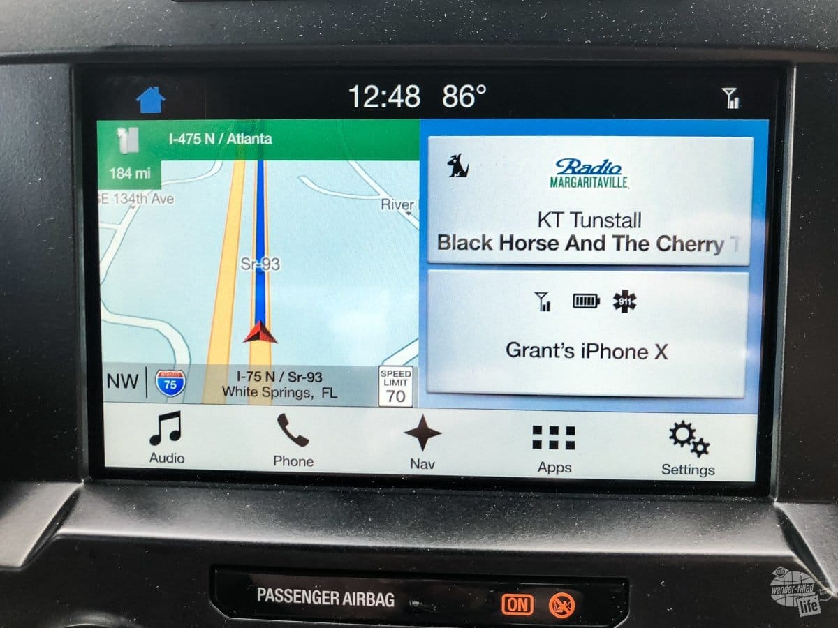
Now, we generally use the built-in navigation on our truck. Honestly, when we bought this truck we didn’t think we needed the navigation. It was part of the package, though, so we ended up with it. It has completely changed our outlook! Now, we’d say it’s an essential upgrade. We love that we don’t have to rely on cell signal and we don’t have to plug anything in.
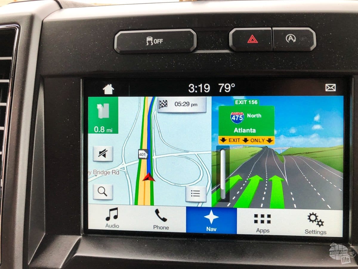
Whether you use built-in navigation, Apple Maps, Google Maps, Waze or something else is completely up to you. They all have their pros and cons. We also suggest keeping a local or regional map or, better yet, a road atlas in the car. You just never know when you won’t have cell service.
If you know where you are planning on going, get some paper maps from AAA! It’s part of your membership.
We also use apps like iExit, Gas Buddy and Pilot to find rest stops, fast food and gas stations.
Check out our article on our favorite road trip apps and our reviews of various navigation apps.
Road Trip Snacks
Obviously, you’re going to need to eat at some point on your road trip. Whether that’s because you’re hungry or just bored, well… That’s a different conversation. Regardless, snacks are probably one of the most important items of our road trip essentials.
If you’re like us, it’s easy to get hangry (hungry and angry) if you haven’t eaten in a while. And, let’s be honest, on a road trip you can’t always just stop for a meal anytime you want. Especially if you’re road-tripping out west, the exits can be very far apart and the food options even more limited.
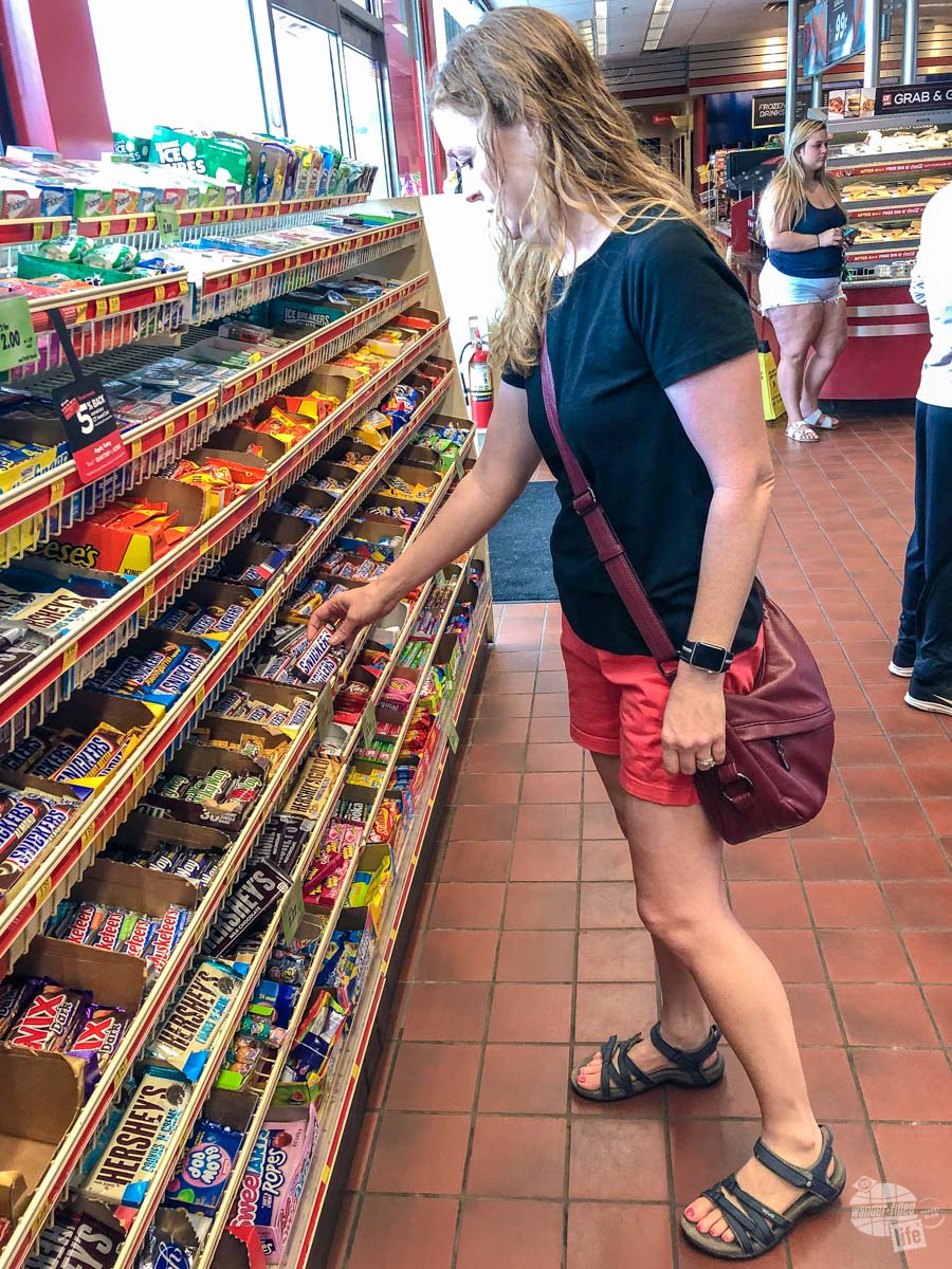
For this reason, we always suggest keeping a few snacks and maybe a cooler in the car with you. This way, you can plan ahead to have some healthy snacks for when you just need food now and you’re so hungry you don’t care what it is!
Whether you’re partial to healthy snacks or guilty indulgences, you should always have a few things nearby to snack on. We like beef jerky, peanut M&Ms and Dr. Pepper. But take whatever it is you like.
Also, if you stop at a gas station to use the bathroom, PLEASE support it by buying a snack or drink. This is especially important if it is a small “mom and pop” type of place. It’s just the courteous thing to do.
Need some inspiration for your snacks? Check out our Favorite Road Trip Snacks here!
Some Rockin’ Tunes
Whether you’re streaming the latest podcast, you have a subscription to SiriusXM or are living in the 90s with a mix tape, you’re going to want something to listen to on your road trip. Regardless of where you’re going, we suggest you NOT rely on FM radio for your entire trip.
Even in well-populated and well-covered regions you’ll run out of radio station quickly when you’re constantly on the move. Having to search for a new station every 20-30 minutes gets old fast. And, if you’re driving through rural Kansas, well… Just trust us, you want your own music!
If you’re really serious about road-tripping, consider paying for a subscription to SiriusXM. It took us a few trips to realize just how much of a lifesaver it is but we gladly pay the monthly fee now. That said, there are a few areas (canyons, heavily wooded regions) where we do sometimes have difficulty getting a consistent stream of music.
For that, we have a small USB drive with music loaded on it we can listen to. We also try to keep a few podcasts downloaded on our phones.

The Right Travel Partner(s)
While some folks like to travel on their own, I think most of us prefer to have someone with us. That can be your significant other, kids, friends or even pets. Choose wisely, though!
Traveling can bring up stressful situations. Even the best of friends or couples madly in love will be tested at some point while traveling, I promise!
If travel is important to you, travel with your significant other early in the relationship. Everyone’s travel style and expectations are different. Some people like adventure and want to constantly explore. Others just want to sit by the pool and relax. If traveling is important to you, you’ll want to know if you and your partner can do that together early on.
For families, you’ll want to set expectations when the kids are young. And, understand your challenges will change over time. We don’t have kids and only occasionally travel with our nieces, so we can’t offer any advice here. All I know is that my sister and I routinely fought while stuck in the backseat of the car on road trips, as did Grant and his sister. I think that’s fairly normal.
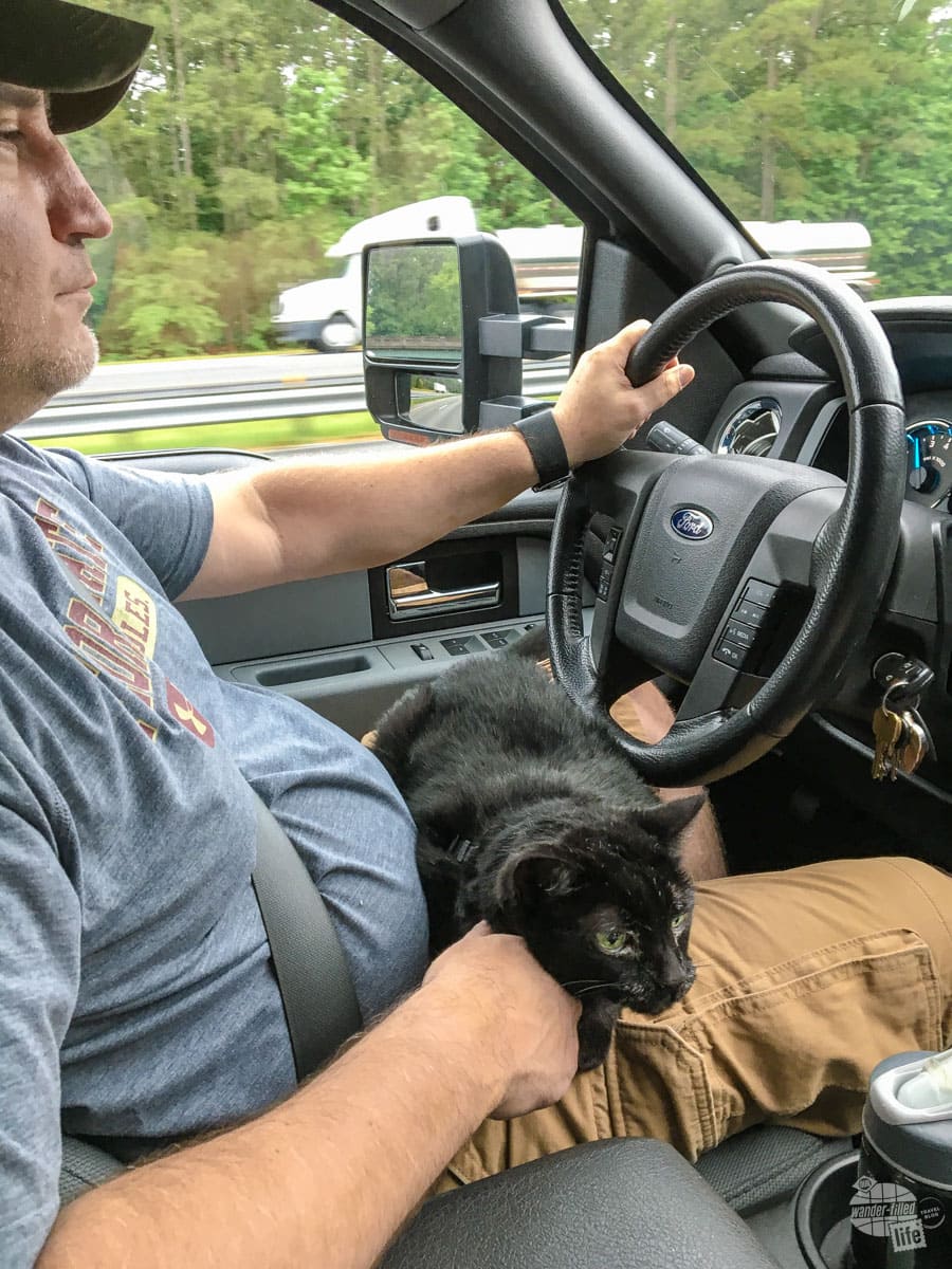
If you want to travel with your dog or cat (or any other animal), know what you’re getting yourself into. Start with a short trip or just an afternoon drive to make sure your pet can handle it. And, remember, even stopping at a rest area to go to the bathroom has a whole new set of challenges if you have an animal in the car.
Read more on Traveling with a Cat.
Pro Tip: You can use the remote start feature on your vehicle to lock the door but keep the AC running for your pet while you grab a snack or hit the bathroom.
Appropriate Emergency Gear
For any road trip, we always suggest having at least basic emergency gear. This doesn’t have to be anything complicated – just make sure you can deal with the basics and keep yourself safe.
At the very least, you should have the equipment (and know how to use it) to be able to change a tire. Even if you have AAA, which we love, it might take hours for them to get to you or you might be somewhere without cell service. Being able to handle that relatively easy task is something any driver should be able to do. If you have a newer car, check to see if you even have a spare tire! Some cars don’t come with them!
We always recommend keeping something to eat and something to drink in the vehicle with you, especially out West. There are some long sections of road that you might not see another person on for hours. Breaking down in a place like that can be a bit disconcerting. If it’s hot, it can be downright dangerous.
We also recommend keeping a first aid kit in the car for both minor wounds and emergencies. A basic kit will do for most folks but the folks at MyMedic also make an advanced kit which is quite good for anyone with a bit of medical training.
We recently got a cell phone booster and tried it out in the middle of nowhere New Mexico. We were impressed at how well the weBoost Drive Reach Cell Phone Booster Kit worked. It made a huge difference in the signal we were able to get. It won’t help you if there is simply no signal to be found but it will help you make the most out of a little signal.
Read more on putting together an emergency kit for the road here.
For those of you who carry a firearm, be sure to know the gun laws everywhere you are visiting and everywhere you are traveling through. Yes, it is possible to go from a law-abiding citizen to committing a felony just by crossing a state line. Know the laws and what condition your firearm needs to be in before you get to any new state.
Read more tips on Traveling with a Firearm.
If you’re driving in the winter, we suggest carrying snow chains or cables if you are going anywhere that it might snow. We’ve had our chains for a few years and, thankfully, have never had to use them. That said, I’d rather have them and not need them than need them and not have them. We also usually carry a few extra snacks and an emergency blanket when traveling in the winter.
Check out our full list of suggestions on Preparing for a Winter Road Trip.
Final Thoughts on the Road Trip Essentials
Preparing for a road trip can be overwhelming. For a good road trip, though, it’s absolutely worth it! Don’t let preparing for the trip stress you too much, though. Make sure you have (or have at least considered) these road trip essentials.
Beyond that, know that something likely will “go wrong;” that is true for any type of travel. Just be prepared to take Grant’s advice and “improvise, adapt and overcome.”
If you forget to pack something, stop at a store along the way. When you hit traffic, just relax and enjoy what you can (and maybe dig into that snack bag). If the kids won’t stop arguing, turn up the radio a bit louder.
Remember, a good road trip is about the journey, not the destination. Expect the unexpected and enjoy whatever comes your way. Often, the most unexpected twists are the most memorable. If nothing else, you’ll come home with a good story.
Travel Resources
What do you use to find a flight?
We use Skyscanner to find deals on flights. Skyscanner has a great interface and compares tons of airlines for the best pricing and routing. That said, it does not always have every airline and some airlines will have better deals on their website. Still, Skyscanner is a great place to start.
Click here to search for a flight.
What do you use to find a hotel?
We typically stay at Hilton properties, so we use the Hilton website. You can find good Hilton Honors discounts or AAA discounts for a hotel there. We make great use of our free night certificates from our Hilton Honors American Express.
Click here to book a Hilton property.
If there are no Hilton properties available, we use TripAdvisor to read reviews and book the hotel. We find we can get the best price that way.
Click here to search for a hotel.
We recently partnered with Stay22 to add interactive maps to each of our destination posts. This will allow you to see a plethora of hotels and vacation rentals all in one responsive map of the area.
What if I need more space than I can get at a hotel?
We use Vrbo for the times when we have rented a cabin for a weekend getaway, like this cabin in Townsend, TN, or needed to rent a house for a large family vacation. We had a great experience with them in terms of refunding deposits when COVID hit and will continue to use them.
Click here to search for a vacation rental.
Who do you use for rental cars?
As a general rule, we book with Hertz for rental cars. We have had nothing but good experiences with them. Plus, we really like unlimited mileage and not worrying about crossing state lines. We have even rented from Hertz overseas in both Slovenia and Croatia.
Click here to book a rental car.
How about booking a cruise?
We have found some amazing prices for booking a cruise through Cruise Direct. We have saved a lot of money on our cruises compared to what we found elsewhere, making a last-minute Bahamas cruise even cheaper.
Click here to book a cruise.
What if I want to rent an RV?
We highly recommend Outdoorsy for RV rentals. We rented a camper van for a week to visit Rocky Mountain National Park for the elk rut and Custer State Park for the Buffalo Round-Up and had a blast. The program was easy to use and we really enjoyed the freedom of having a camper van for that trip.
Click here to rent an RV.
What do you use for booking tours?
We don’t often book tours. Typically, we like to do stuff on our own. That said, there are some experiences you can’t have any other way. So, when we do want to book a tour, we always check Viator first.
Click here to book a tour.
Do you use anything to get discounts on the road?
We make extensive use of both Good Sam and AAA on the road. Good Sam is normally regarded as a discount card for RVers at campgrounds and Camping World but anyone can use the 5 cents off a gallon at the pump at both Pilot and Flying J.
Click here to get a Good Sam membership.
We have had AAA as long as we have been married and it has more than paid for itself in discounts at hotels, aside from the peace of mind of having roadside assistance. Add in paper maps and the ability to get an international driver’s license and it is more than worth it for any traveler out there.
Click here to get a AAA membership.
First of all, I’m new to your website/blog, but the info I’ve read so far has been very helpful.
My husband and I have a 19foot RoadTrek; we tow a Smart car, and carry our two bicycles on the back of the Smart car. We’ve done several 3-5 day trips and right before Christmas did an 18-day Holiday Lights and Beaches trip through the lowcountry of South Carolina. We did four drive thru light shows and many beaches while staying at four different RV parks.
As we begin planning for longer trips, I’m wondering what suggestions you have for getting prescription refills on your longer trips.
Hi Diane!
Thanks for your comment. I love your trip in South Carolina… That’s awesome!
Here’s how I have dealt with getting prescription refills on the road:
On our first long road trip since my heart attack, all of my prescriptions were monthly. I filled them at CVS since it is a nationwide pharmacy. I was able to stop at a CVS in Hyde Park, NY to get my prescription filled. While it worked, it was a pain. Instead of being a one-time move, the pharmacy in New York moved my prescription permanently.
After that, I started getting 90-day supplies of my meds, which works a LOT better. I typically fill my prescription right before I head out on road in the summer and I am good to go until well after we get back.
That said, I know that is not an option for everyone. So, I recommend you choose either CVS, Walgreens or Wal-Mart for your prescriptions if you can only get a 30-day supply. Wal-mart, in particular, has locations all over the country and can be found much more regularly than either CVS or Walgreens in rural areas.
I hope that helps!