Last Updated on February 22, 2024 by Grant
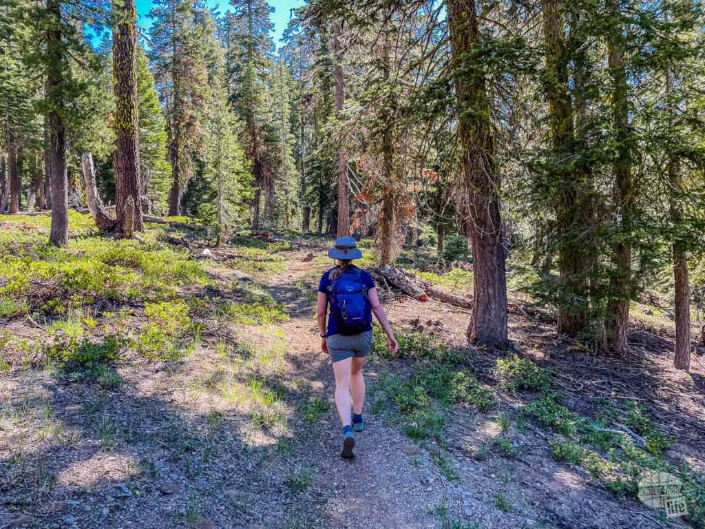
When it comes to getting out on the trail, Lassen Volcanic National Park offers a lot of opportunities. Seriously, day hiking in Lassen Volcanic National Park is the perfect way to explore the thermal features of this unique park, as well as find some great views.
We made a point to hike both along the main road and out in the more remote areas of the park. Indeed, some of our favorite trails in the park require a bit of getting to. One thing to note: while we did these hikes in mid-June, many don’t open until the snow melts which can be much later.
So, let’s get out on the trail for some day hikes!
About three weeks after we visited Lassen Volcanic National Park, the Dixie Fire roared through the park, damaging and destroying several structures. Please check the park website for current conditions.
(Disclaimer: When we link to places where you can buy our stuff or places we stayed, we are using special codes that earn us commissions on the sales at no additional cost to you. Please see our Review Policy for more information.)
A Few Words of Safety on Day Hiking in Lassen Volcanic National Park
For the most part, day hiking in Lassen Volcanic National Park is perfectly safe. Most of the trails see enough people so that if you have a problem, help is not that far away. That said, whenever you go into the backcountry, it is important to be prepared.
Check out our 10 essentials for hiking here.
We are firm believers that you should always carry the 10 Essentials with your group, preferably on each person. These basics will keep you alive if something unfortunate happens and you are stuck in the wilderness overnight.
Especially in the center of the park, understand you are at altitude and that can severely impact your body and its ability to perform. Also, this is bear country and the park has around 50 black bears. While you won’t need bear spray, you do need to make sure your food and other scented items are stored properly when in the park.
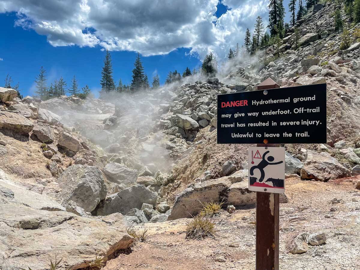
Lastly, pay attention to the warning signs around the hydrothermal areas. You can be seriously hurt or killed by wandering into a thermal feature.
Day Hikes on the Main Park Road
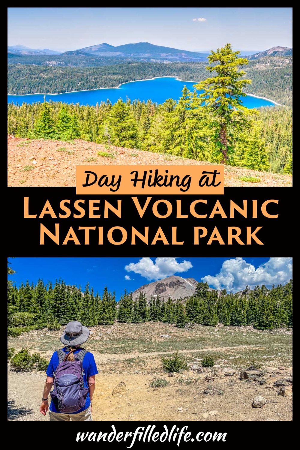
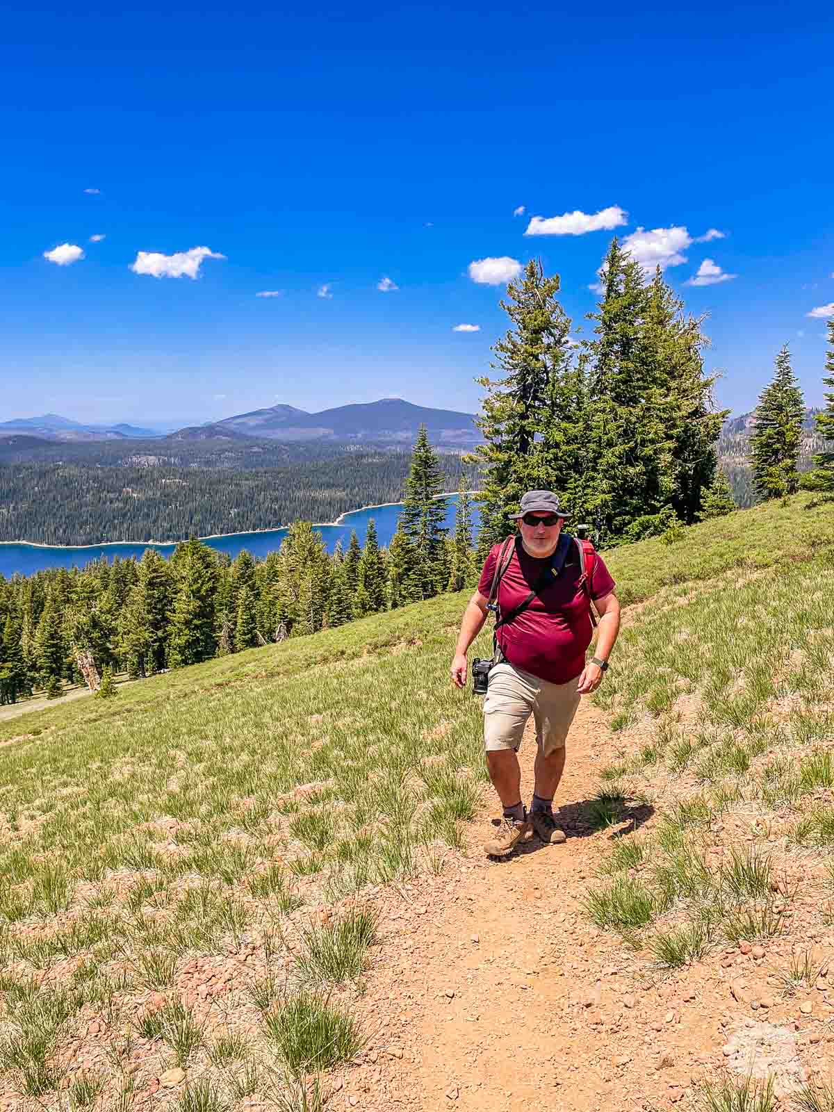
We made a point to hike three trails along the main park road and experienced quite different landscapes along the way. We got to see some staggering views of the crater left by the volcano Tehoma. This allowed us to explore the best hydrothermal areas outside of Yellowstone. We finally found some wildlife along a serene lake.
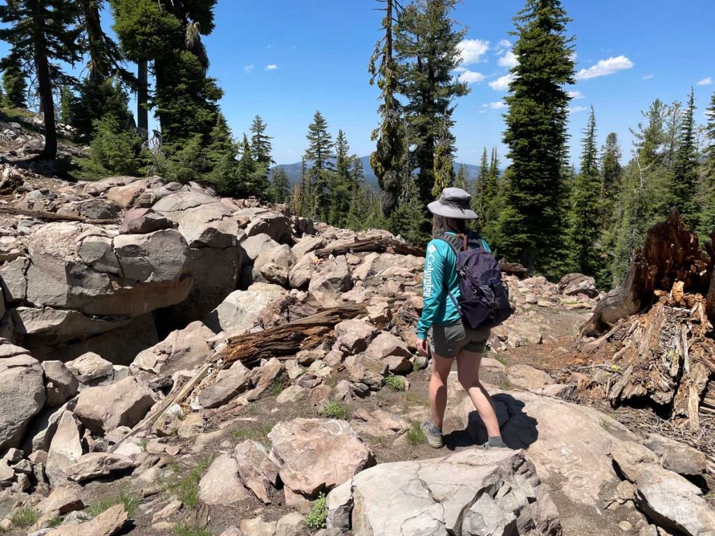
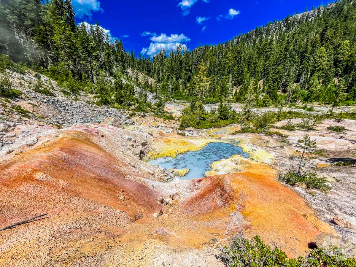
Bumpus Hell Trail
3 miles |460 feet elevation change
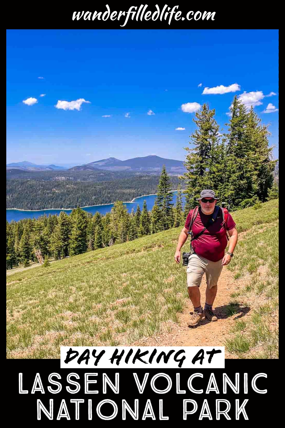
This trail is the crown jewel of day hikes in Lassen Volcanic National Park. If you do no other trails, do this trail. Yes, it is crowded but that’s for a good reason!
We found the parking lot for this trailhead filled up by midmorning pretty much every day we were in the park. That said, even the parking lot has great views and some great informational signs on Tehoma. Don’t worry if you miss the signs, though. You can find the same info on a short spur trail off to the right.
Pro tip: If the parking lot is full, check the parking around Helen Lake. If you cross the road, you will see a trail heading up the bank. That connects quickly with the Bumpus Hell Trail.
The trail itself has tremendous views and some steep drop-offs until you get to the overlook of the hydrothermal area.
Once you get to the overlook, you are presented with a choice: continue on the trail to the right or take the Frying Pan alternative trail to the left. I recommend taking the Frying Pan trail down to the hydrothermal areas. Simply, the views are better on this trail on the way down.
The descent will bring you to the hydrothermal area. Be sure you stay on the trails and boardwalks! This area is full of thin crust over thermal features. Indeed, the guy this area is named after actually lost his leg when he stepped into a mud pot!
You can keep following the trail which will take you to Cold Boiling Lake if you are looking for a much longer hike with a lot more elevation change. Or just loop back onto the main trail, which has a much easier grade than the Frying Pan Trail.
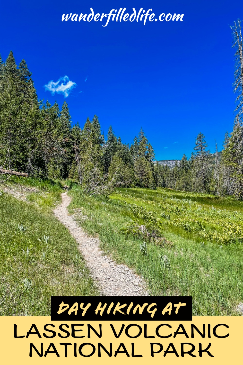
Cold Boiling Lake
1.5 miles | 134 feet elevation change
Cold Boiling Lake is sold as a former hydrothermal area. The lake is supposed to look like it is boiling even though it is cool and the bubbles are due to gases underneath.
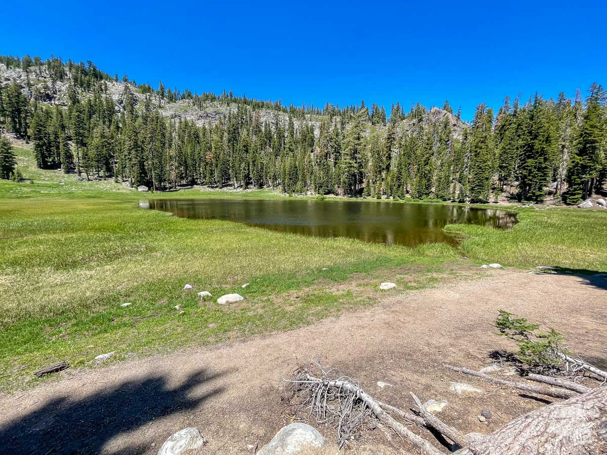
Honestly, though, there was only one small gas vent and that’s it. It was underwhelming. Still, if you are looking for a relatively short and easy hike, this is a good choice.
While the lake itself isn’t super exciting as a thermal feature, we enjoyed the short hike and the lake is pretty.
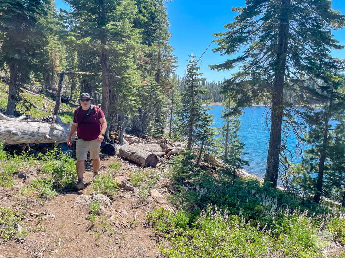
Manzanita Lake
2 miles |46 feet elevation change
This trail on the north end of the main road circles the lake right by the Loomis Museum, which serves as the visitor center at this end of the park.
This shaded, easy amble along the lake’s shore is especially rewarding early in the day. Not only will you have a better chance of spotting wildlife, but you will also have less breeze on the lake, making for excellent reflections of Lassen Peak.
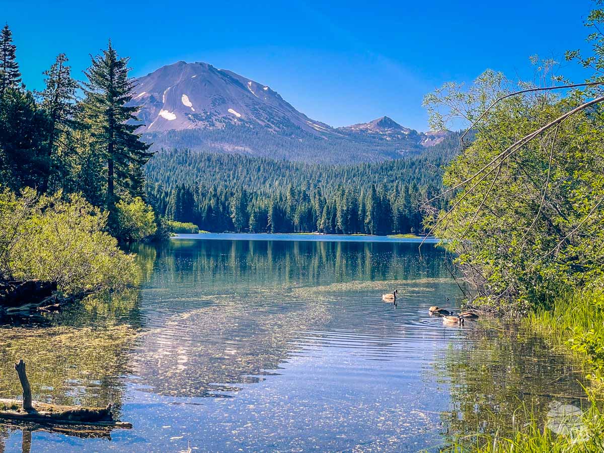
We really enjoyed this trail. While there is nothing dramatic about it, it does have excellent views of Lassen Peak and some of the only wildlife we spotted in this park (a couple of deer).
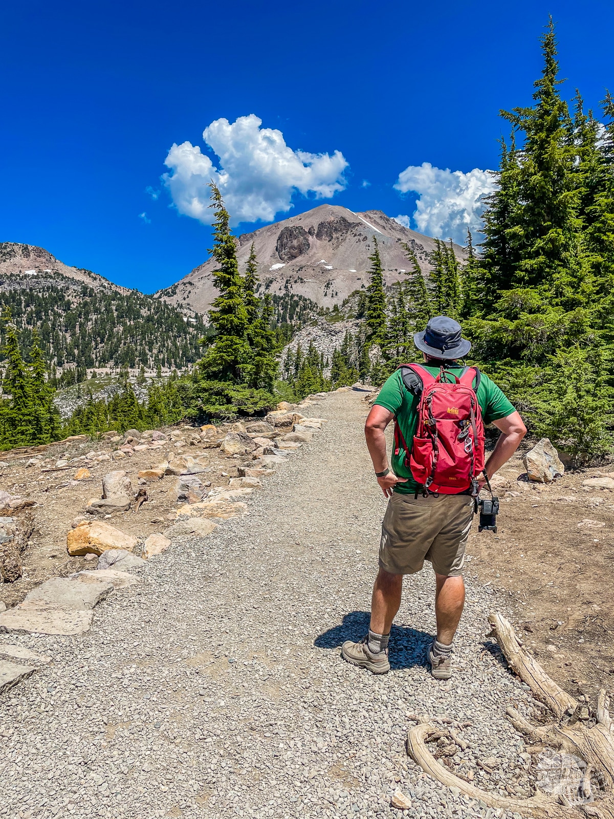
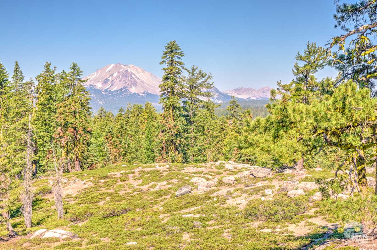
Lassen Peak
4.8 miles | 1,957 feet elevation change
No, we didn’t hike this trail. But we did stop at the parking lot to admire the view and the snow still on the ground up over 8,000 feet.
So, let’s talk about why we didn’t hike this trail. It goes up nearly 2,000 feet in 2.4 miles to a total of 10,456 feet. There is no shade along the trail.
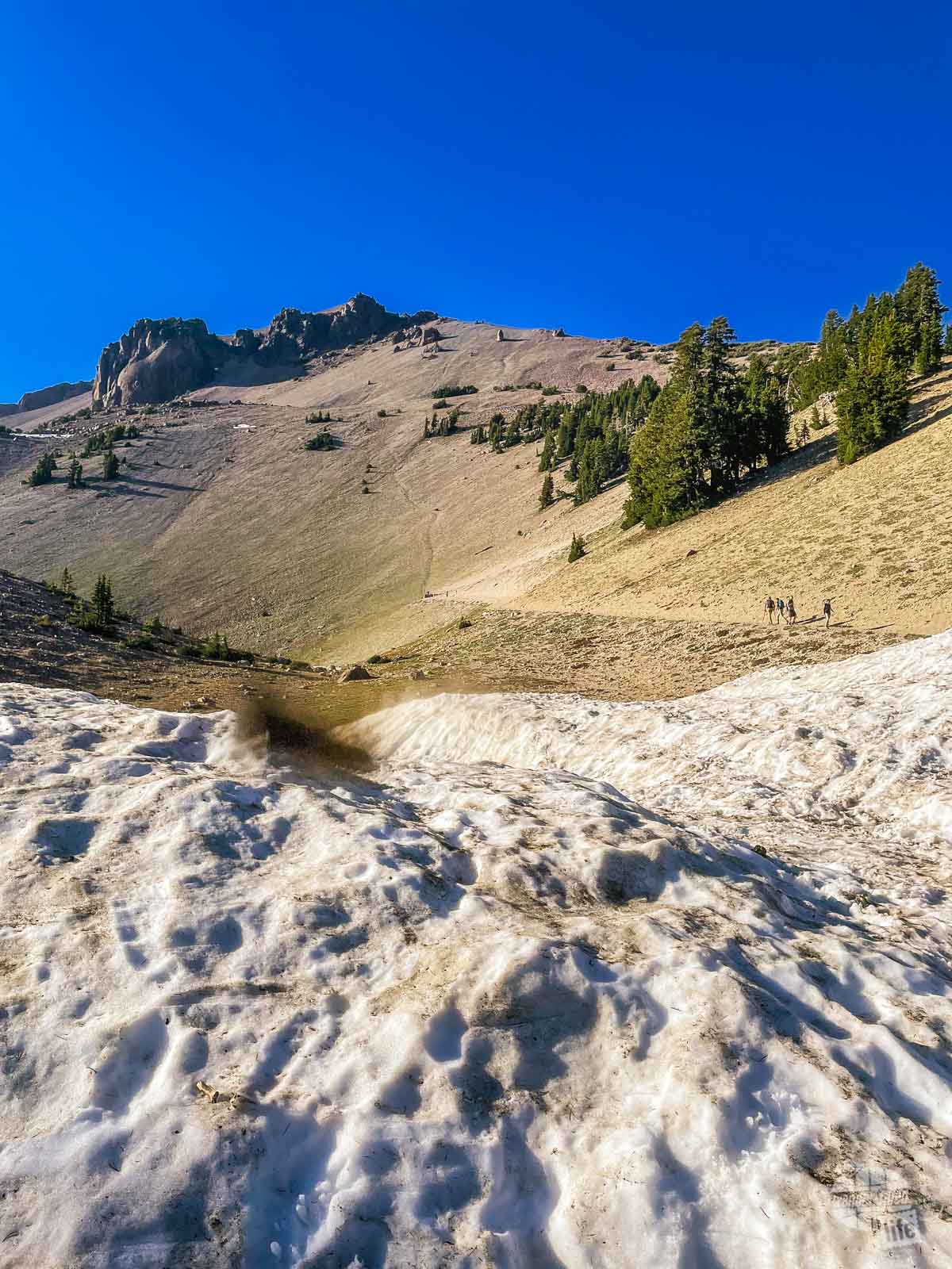
While I am sure the view from the top is spectacular, that’s not the kind of trail we typically enjoy. Still, I wanted to include it for the folks who love hiking steep trails. Just do your research and know what to expect.
Juniper Lake Area
Getting out to Juniper Lake requires driving out of the park to the town of Chester and then back north through the Lassen National Forest on a somewhat rugged dirt road until you enter back into the park. You can definitely tell the difference between how the Forest Service and the Park Service maintain the road.
The Park Service said we needed a high clearance vehicle for this road but we did not feel it was that rough. Just take it slow and you will be fine.
There is no entrance station here, so be sure you have your park pass with you or have cash to pay the entrance fee. If you have already paid the entrance fee for the park, that is sufficient as long as it is visible on your dash.
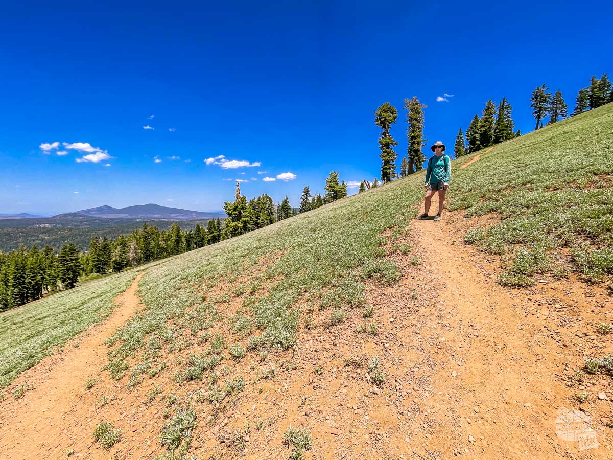
Inspiration Point Trail
1.7 miles | 440 feet elevation change
If you only do one hike at Juniper Lake, do this hike. The views are spectacular for a not that tough hike. That said, be prepared that the trail is a relatively steep uphill for its short distance.
The trail is wooded pretty much the entire way up until you get to the low ridgeline. From there, you will have great views of Cinder Cone and Snag Lake. Keep heading along the trail on the ridge for great views of Lassen Peak.
When we were there in mid-June, the mosquitos hit us pretty much as soon as we got out of the truck, so having some bug spray would be handy, especially early in the season when the mosquitos are first hatching.
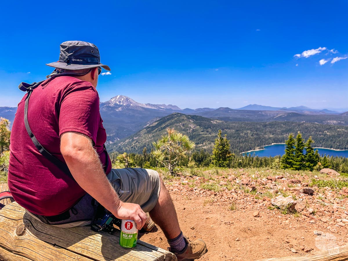
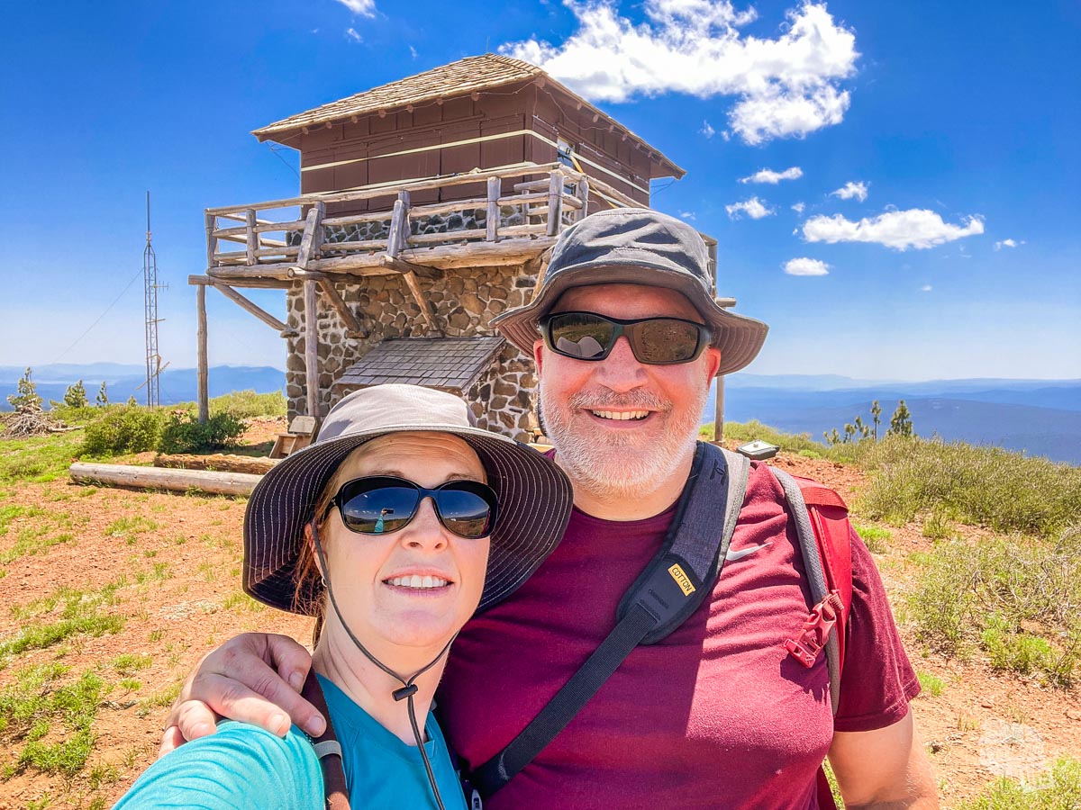
Mount Harkness Trail
3.8 miles | 1,246 feet of elevation change
The park ranger recommended this hike as one of the best views in the park and I have to say she was right. This trail ascends up through the woods up to an active fire tower atop the mountain with panoramic views in every direction.
For the vast majority of the trail, you are hiking through a nice shady forest. For the last half mile or so, it opens up to an alpine meadow, so make sure you have appropriate sun protection with you.
We were certainly huffing and puffing our way up the switchbacks leading to the fire tower but when we got to the top, the views were SO worth it!
Ironically, especially considering the enhanced fire danger this year, the fire tower was closed. When we asked the ranger about it later, she said the policy had not caught up to the realities of climate change and the tower wasn’t scheduled to be opened until July 1.
When you get to the top, be sure to check out the short spur trail which takes you out to the perfect seat to admire the view!
Mount Harkness Loop via Juniper Lake Trail
6.3 miles | 1,298 feet of elevation change
If you are looking at the map thinking, “Hey, I can turn the Mount Harkness Trail into a loop and come back on the Juniper Lake Trail!,” well, you can. But I wouldn’t. At least, in hindsight, I wouldn’t.
We started descending Mount Harkness and found this trail to the lake to be a LOT more rugged and hard on our feet and knees. While the views coming down were nice, we felt this portion of the trail was significantly more difficult than the “normal” trail.
All of that said, the hike along Juniper Lake Trail was nice and easy. While there was a bit of brief up and down, the Juniper Lake Trail has some great views of the lake and is worth your time.
Bottom line, I would hike up and down the main Mount Harkness Trail and then hike out the Juniper Lake Trail as far as you want. If you decide to do the loop, just be prepared for rugged, steep conditions on the connecting trail.
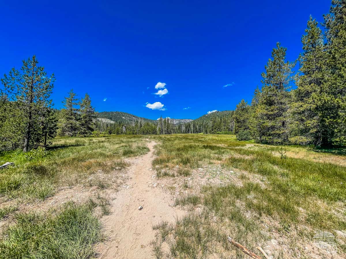
Warner Valley Area
Like Juniper Lake, Warner Valley requires you to head south to Chester and then turn back north towards the park. It’s actually initially the same road you used to go to Juniper Lake. As you go north, you will follow the signs for the Drakesbad Guest Ranch, a guest ranch inside the park in Warner Valley.
The road out to Warner Valley is not as rough as the one to Juniper Lake but you will want to take it easy on the Forest Service portion of the road until you enter the park.
Also like Juniper Lake, display your park pass or pay cash at the unmanned entrance station.
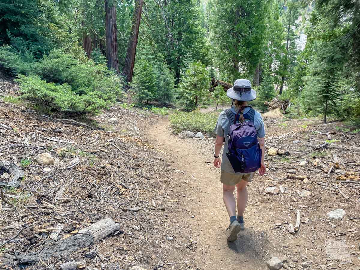
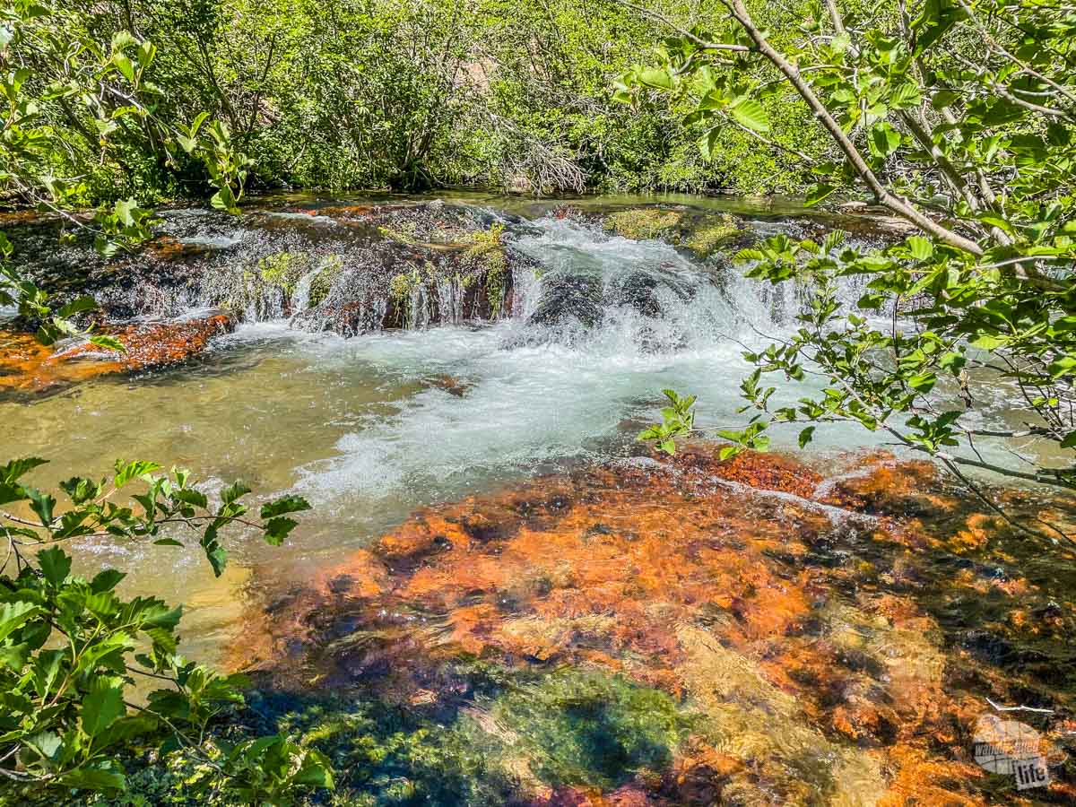
Devils Kitchen Trail
5.4 miles |639 feet elevation change
The Devils Kitchen Trail meanders through the open Warner Valley for about half the trail. As you walk through, you will be treated to gorgeous views of the valley until it enters into the forest on the far side. Keep your eye out here for wildlife, especially early in the morning.
As you head into the woods, the trail starts going uphill but the grade isn’t bad. Once you get to the end of the trail, you will spot an area for horses from the ranch to tie up. Then head down into Devils Kitchen.
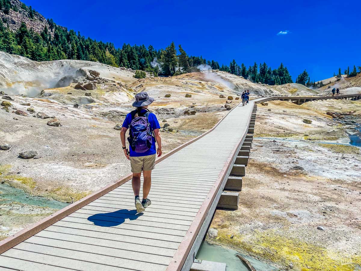
This hydrothermal area is the second largest in the park and is full of steam vents, fumaroles and mud pots. There is an excellent trail that loops through the area and, like Bumpus Hell, make sure you stay on the trail to avoid serious injury.
We actually enjoyed this area even more than Bumpus Hell because we had it to ourselves when we visited! While we saw a few other folks during the hike there and back, we did not see anyone else right here at Devils Kitchen.
There are several other trails in the area which join and leave this trail so be sure to keep an eye on the trail signs!
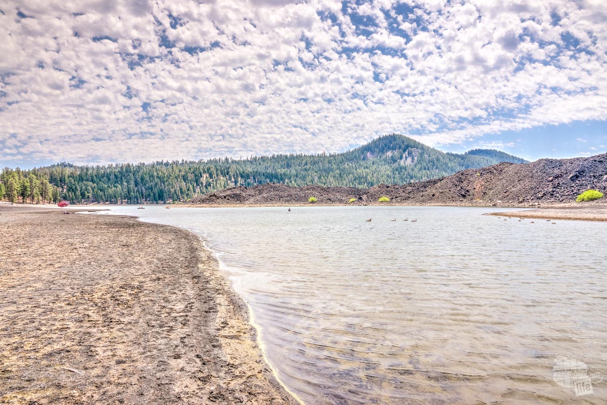
Butte Lake Area
Butte Lake is on the northeast end of the park and takes quite a bit of driving to get to if you are coming from the south end of the park.
What makes the Butte Lake area worth your time are the lava fields and Cinder Cone. These distinctive volcanic features make for a unique visit. The area has quite a few hiking trails, so you can spend several days exploring.
Like the other two remote parts of the park, you need to have a park pass displayed on your window.
Cinder Cone Trail
4 Miles | 846 feet Elevation Change
I am not going to lie, we did not hike the entire trail. Instead, we hiked out far enough to get a decent view of Cinder Cone.
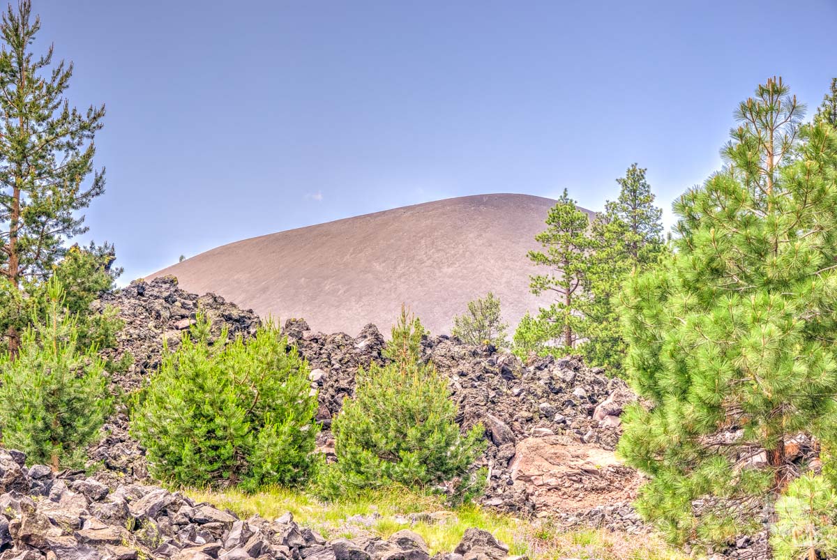
The reason for this is most of the trail is volcanic sand. We DO NOT like hiking in sand. Still, we wanted to be able to see the lava fields and Cinder Cone, so we hiked out about a mile. If you have never seen lava fields, it is something to behold, especially because of how inhospitable the lava fields are.
Read more about visiting lava fields at Craters of the Moon National Monument and Preserve here.
Still, most of the early part of the trail is shaded, which is a godsend if you are thinking about hiking to the top of the Cinder Cone because that portion of the hike is completely exposed. Like Lassen Peak, this is a fairly strenuous hike so make sure you are prepared before you hit the trail.
Final Thoughts on Day Hiking in Lassen Volcanic National Park
Lassen Volcanic National Park is perfect for a day hiker. There are several great trails that can keep you busy for days. We spent 4.5 days in the park and could easily go back and spend several more days hiking.
The biggest piece of advice I have for folks visiting the park is don’t feel like you have to stay along the main park road for hikes. We especially enjoyed both Juniper Lake and Warner Valley for their gorgeous views.
Be sure to check out Bonnie’s guide to Lassen Volcanic National Park here.
In all, day hiking in Lassen Volcanic National Park is really rewarding. Aside from the amazing views and solitude, the hydrothermal features are quite unique, exceeded only by Yellowstone National Park.
Travel Resources
What do you use to find a flight?
We use Skyscanner to find deals on flights. Skyscanner has a great interface and compares tons of airlines for the best pricing and routing. That said, it does not always have every airline and some airlines will have better deals on their website. Still, Skyscanner is a great place to start.
Click here to search for a flight.
What do you use to find a hotel?
We typically stay at Hilton properties, so we use the Hilton website. You can find good Hilton Honors discounts or AAA discounts for a hotel there. We make great use of our free night certificates from our Hilton Honors American Express.
Click here to book a Hilton property.
If there are no Hilton properties available, we use TripAdvisor to read reviews and book the hotel. We find we can get the best price that way.
Click here to search for a hotel.
We recently partnered with Stay22 to add interactive maps to each of our destination posts. This will allow you to see a plethora of hotels and vacation rentals all in one responsive map of the area.
What if I need more space than I can get at a hotel?
We use Vrbo for the times when we have rented a cabin for a weekend getaway, like this cabin in Townsend, TN, or needed to rent a house for a large family vacation. We had a great experience with them in terms of refunding deposits when COVID hit and will continue to use them.
Click here to search for a vacation rental.
Who do you use for rental cars?
As a general rule, we book with Hertz for rental cars. We have had nothing but good experiences with them. Plus, we really like unlimited mileage and not worrying about crossing state lines. We have even rented from Hertz overseas in both Slovenia and Croatia.
Click here to book a rental car.
How about booking a cruise?
We have found some amazing prices for booking a cruise through Cruise Direct. We have saved a lot of money on our cruises compared to what we found elsewhere, making a last-minute Bahamas cruise even cheaper.
Click here to book a cruise.
What if I want to rent an RV?
We highly recommend Outdoorsy for RV rentals. We rented a camper van for a week to visit Rocky Mountain National Park for the elk rut and Custer State Park for the Buffalo Round-Up and had a blast. The program was easy to use and we really enjoyed the freedom of having a camper van for that trip.
Click here to rent an RV.
What do you use for booking tours?
We don’t often book tours. Typically, we like to do stuff on our own. That said, there are some experiences you can’t have any other way. So, when we do want to book a tour, we always check Viator first.
Click here to book a tour.
Do you use anything to get discounts on the road?
We make extensive use of both Good Sam and AAA on the road. Good Sam is normally regarded as a discount card for RVers at campgrounds and Camping World but anyone can use the 5 cents off a gallon at the pump at both Pilot and Flying J.
Click here to get a Good Sam membership.
We have had AAA as long as we have been married and it has more than paid for itself in discounts at hotels, aside from the peace of mind of having roadside assistance. Add in paper maps and the ability to get an international driver’s license and it is more than worth it for any traveler out there.
Click here to get a AAA membership.